Los Cinco SolesDistinguished Mexican Arts and CraftsClick for more info / Clickea por más información
SkyReef Beach ClubSnorkel, Beach, Bar & GrillClick for more info / Clickea por más información
Pancho's BackyardColonial-style restaurants on Melgar ave. and Puerta Maya PierClick here for more info / Clickea por más información

Cozumel, Texas


Cozumel, Texas

Copyright 2011, Ric Hajovsky

In June 1837, one year after the Republic of Texas became independent from Mexico, the Texas Secretary of the Navy, Samuel Rhoades Fisher, sent the two Texas Navy Schooners of War (the Brutus and the Invincible) to the coast of Yucatan to harass Mexican shipping in retaliation for Mexican blockade of Texas ports. This was against the express wishes of the President of Texas, Sam Houston. After raiding several Yucatecan towns and capturing several Mexican vessels, the Texan fleet sent a landing party ashore at Cozumel and claimed the island formally for the Republic of Texas. The Texian Navy Commander Henry Livingston Thompson of the Brutus sent a dispatch on August 29, 1837, to his headquarters in Galveston regarding this foray, containing the following lines:

“We then bore away for the Island of Cazomel which we found to be one of the most desirable places in all the circle of my travels. We immediately after coming to an anchor went on shore and took possession under a salute of 23 guns and with a hearty welcome by the inhabitants on the seaboard. We surveyed the Island as well as circumstances would admit and still became more infatuated with its delightful situation and the salubrious trade wind which blows without cessation. This connected with the beautiful roadstead and anchorage and the richest of soils which produces the finest kind of timber and that of a variety induces me to think, not only think but am well convinced that it will be one of the greatest acquisitions to our beloved country that the Admiral aloft could have bestowed on us. I hoisted the Star spangled Banner at the height of forty-five feet with acclamations both from the inhabitants of the Island and our small patriotic band, the crews of our two vessels. We then filled our water and made sail on our homeward bound passage, passed the Island of Mujeres.”
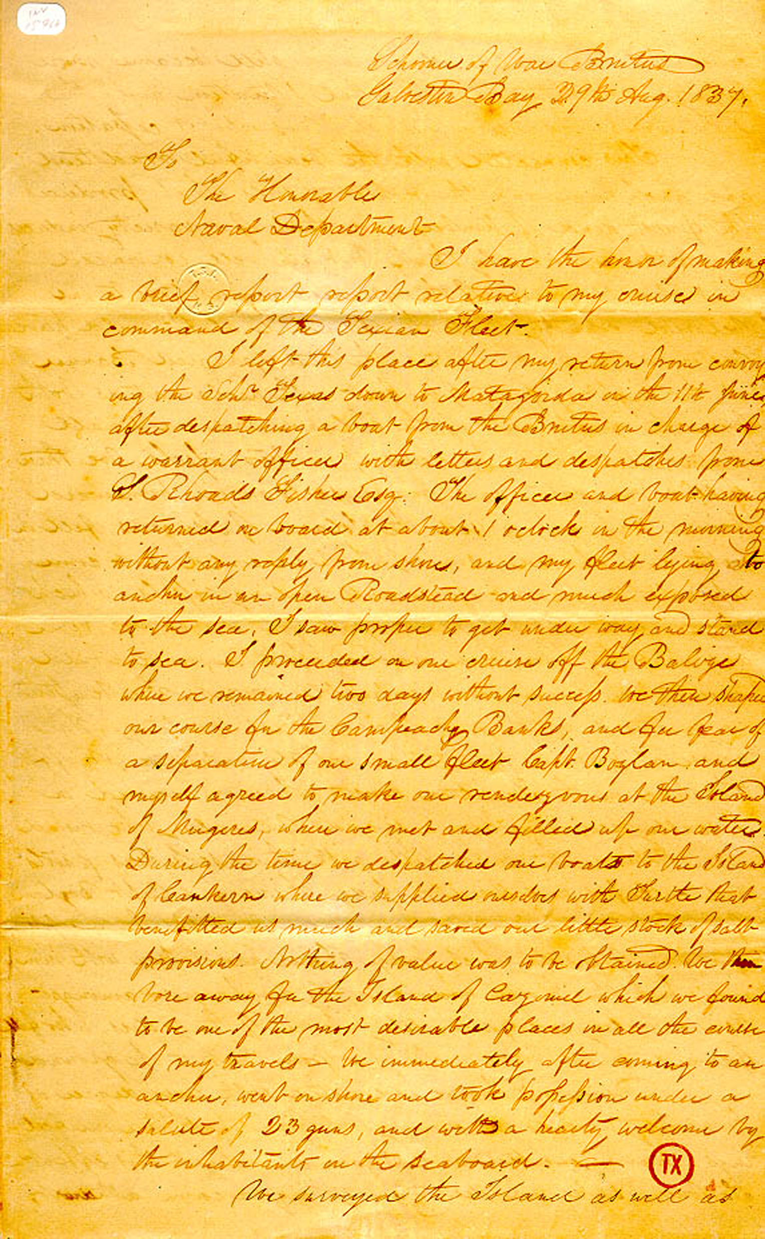
Above: The report H. L. Thompson made, telling of how he claimed Cozumel for the new nation of Texas in 1837.

After Fisher and Thompson submitted their reports of the voyage, they were reprimanded for their actions by the President of Texas, who did not want to upset the status quo with Mexico by claiming part of its territory. Sam Houston then fired the Texas Secretary of the Navy, Samuel Rhoades Fisher, for disobeying orders. Thompson was brought up on charges but died before the trial.

Eleven years later, in 1848, the governor of the independent Republic of Yucatan was losing the War of the Castes to the Maya rebels. As a last desperate measure, the governor of the Republic of Yucatan offered the entire territory to the United States in return for putting down the rebellion but the offer was turned down.

2023-01-13T22:42:29+00:00By |Cozumel History|

Cozumel, Cannibals, and a Catholic Church

Cozumel, Cannibals, and a Catholic Church

Copyright 2018, Ric Hajovsky

In January, 1913, Sylvanus Griswold Morley and Jesse Logan Nusbaum set off from Santa Fe New Mexico on an expedition to Mexico to film a silent feature on the ancient Maya for the Panama-California Exposition that was to be held in San Diego California in 1915. The script that Morley wrote was to tell the story of Maya life at Chichén Itzá, with fanciful scenes of young, sacrificial virgins being thrown into the sacred cenote located there. However, when they finally set up to film in the ruins in February of 1913, they found they had underestimated the funds they needed to build sets, buy costumes, and hire actors. They ditched the project and began travelling around Yucatan filming and photographing whatever struck their fancy. In Tulum, their canoe overturned in the surf and they lost most of their exposed film. The accident also rendered their movie camera inoperable. When the later landed on Cozumel, they only had their still cameras in working order with which to record their experiences there.

Above: The two archaeologists did manage to salvage the negatives of a few shots they staged at Chichén Itzá. Photo Palace of the Governors NM.

Nusbaum and Morley were good friends and had worked together on digs in New Mexico and Guatemala earlier in 1910.

Above: Quiriguá, Guatemala, 1910. Sylvanus Morley is center left, and Jesse Nusbaum is center right. Their two friends are unidentified. Photo Palace of the Governors, NM.

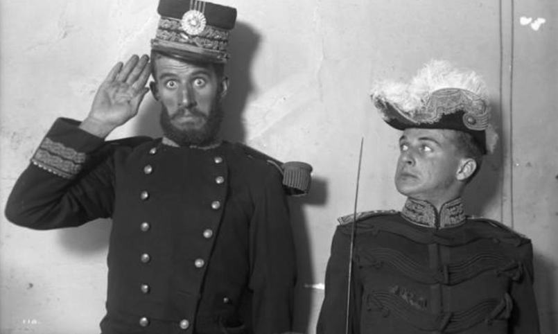
Above: Jesse Nusbaum and a United Fruit Company employee dressed-up in Guatemalan military uniforms, Guatemala City, Guatemala, 1910. Photo Palace of the Governors, NM.

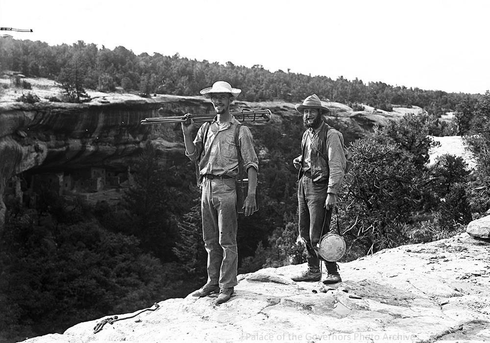
Nusbaum also worked with Alfred V. Kidder in 1908 at Mesa Verde. Kidder was later to fly with Charles Lindbergh in the 1929 aerial survey of Yucatan which included a stop in Cozumel.

Above: Nusbaum on left, Kidder on right at Mesa Verde 1908. Photo, Palace of the Governors, NM.

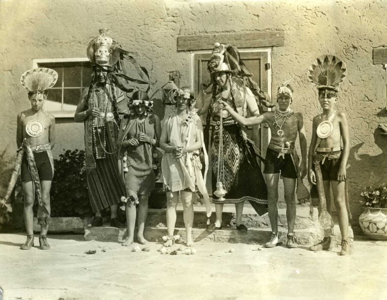
This whole group of the Santa Fe archaeologists were party animals. Below is a photo taken by Nusbaum of his friends at Fiesta, the Santa Fe celebration of the town’s founding:

Above: Nusbaum’s friends dressed for a party in Santa Fe, New Mexico. Photo, Palace of the Governors, NM.

Although I didn’t know Nusbaum’s connection with Cozumel at the time, a couple of friends of mine used Nusbaum’s old home in Santa Fe as their tribal art gallery. My wife and I spent many pleasant evenings, dining and partying at the gallery with them and their guests, a tradition that apparently had carried over from Nusbaum’s days.

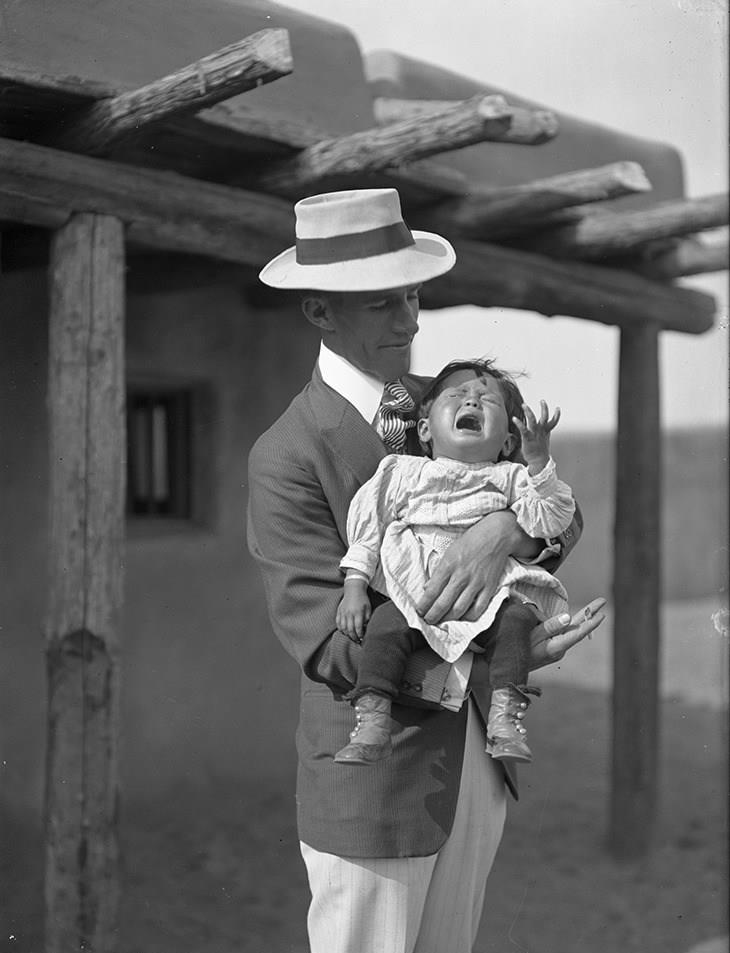
Even though Nusbaum failed to film the movie he wanted for Panama-California Exposition while he was in Yucatan, the archaeologist would later work with the New Mexican government designing the “Painted Desert” pavilion at the exposition in San Diego in 1915. In the photo below, he is shown holding Maria Martinez’ baby. Notice the hand-rolled cigarette in his hand and the rather bemused look on his face. Maria was a potter from San Idelfonso Pueblo in New Mexico. When Nusbaum’s friend and fellow archaeologist, Edgar Lee Hewett, discovered shiny black pottery sherds in a Pueblo Indian excavation he was working on in 1908 and asked Maria to help him figure out how it was made. The young potter experimented a while and eventually found that by reducing the oxygen available to the kiln, the red clay would turn black. She then began producing this black pottery in her pueblo and offering it for sale to tourists and was wildly successful. Nusbaum and Hewitt took her to San Diego for the exposition where she, her husband and baby wore traditional garb for the visitors while they sold their wares. Much later, in the 1970s, Sharon Morales of Cozumel began to buy Maria’s pottery to sell at Sharon’s gift shop “Los Cinco Soles”.

Above: Nusbaum holding Maria Martinez’ baby and a hand-rolled cigarette. I’ll bet I know which one he put down first. Photo, Palace of the Governors, NM

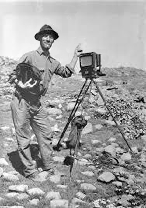
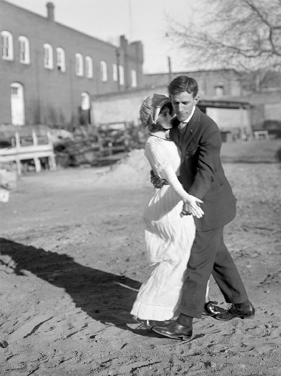
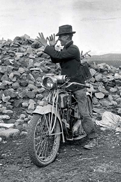
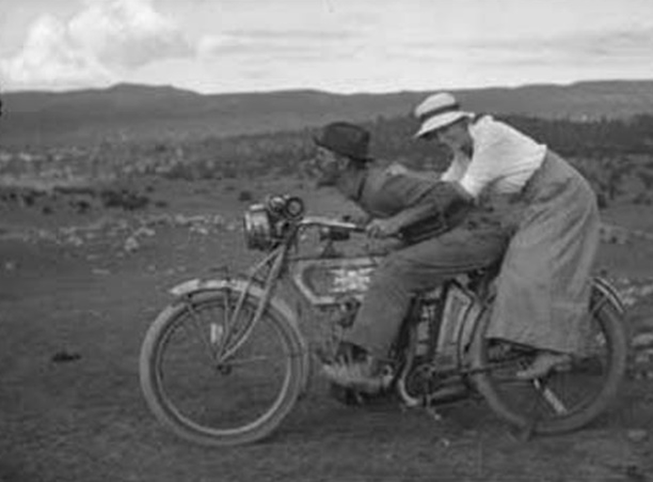
Nusbaum was not only an archaeologist, but also a well-known photographer at the time who delighted in taking self-portraits and posing for shots.

Above: Nusbaum in 1908. Photo, Palace of the Governors, NM.

Above: Nusbaum dancing with mannequin in Santa Fe, 1916. Photo, Palace of the Governors, NM.

Above: Nusbaum and friend, 1917. Photo, Palace of the Governors, NM.

Above: Nusbaum in 1917, prior to entering the army and serving in France. Photo, Palace of the Governors, NM.

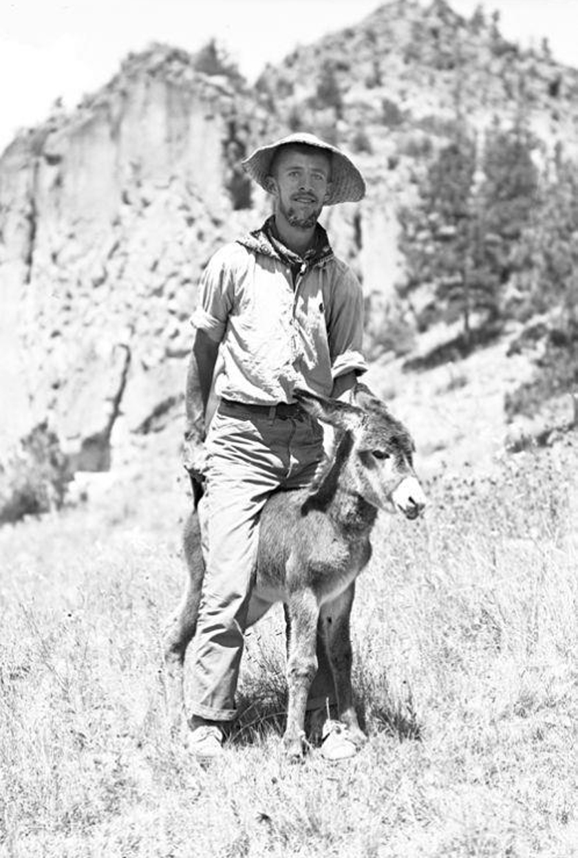
Above: Jesse Nusbaum on burro in Frijoles Canyon, New Mexico, 1908. Photo, Palace of the Governors, NM.

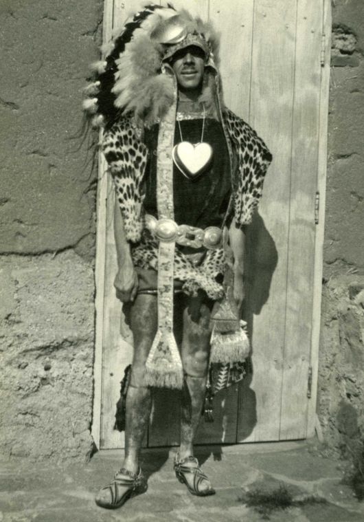
Above: Sylvanus Griswold Morley in Santa Fe and dressed as the Maya priest Ah Kin Mai for a costume party. Photo Palace of the Governors, NM.

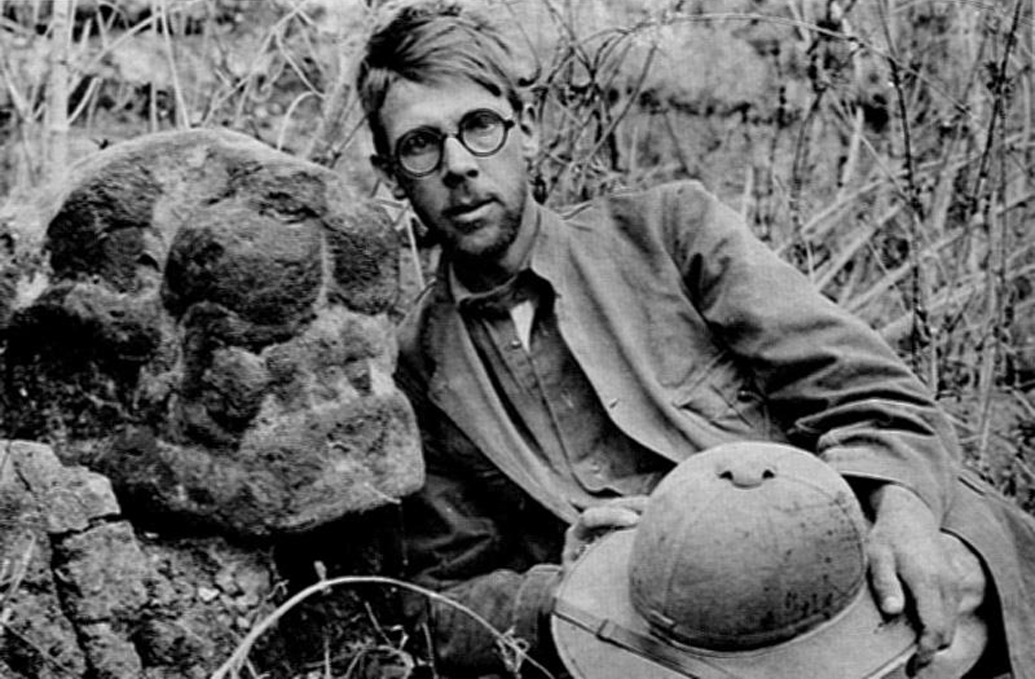
Morley later worked as a spy for the Office of Naval Intelligence (ONI) during WWI, using his cover as an archaeologist to great effect. Some say was the model for the movie character, Indiana Jones. In his quest to find German spies and sympathizers, he again visited the Quintana Roo coast and Cozumel in 1917, sending back coded reports about his finds to Washington.

Above: Morley the archaeologist-spy.

The first time Morley and Nusbaum landed on Cozumel in 1913, they had no way of contacting friends and co-workers back home. This lack of correspondence from the two caused considerable speculation as to their safety, or lack thereof. On April 15, 1913, The Santa Fe New Mexican published a front-page article, “Two Santa Feans Visit Bad Men on Cozumel Isle,” which stated the island was noted for its cannibals. A couple of days later, another front-page article appeared, with the headline: “Grave Danger in Visiting Isle of Cozumel. Peril of Morley-Nusbaum Expedition Facing Cannibals Who Have Eaten Other Explorers. Mrs. Morley Alarmed over Husband’s Fate.” This article included a photo of Nusbaum, and suggested he may have met his end on the island at the hands of cannibals.

Above: Jesse Nusbaum. Photo, Palace of the governors, NM.

The Boston Globe published an article on April 18, headlined “Alarm Felt for Them. S. G. Morley, a Harvard Student, and J. L. Nusbaum May Have Died on Visit to Cozumel Island.” The paper added that there were reports that two Englishmen who visited the island of Cozumel recently were either eaten by cannibals or killed by hostile Indians.

The press never ran any follow up stories after Nusbaum and Morley returned to Santa Fe, safe and sound. I guess if the US State Department had travel advisories back then, they would have included Cozumel as a place to avoid if you didn’t want to be consumed by cannibals.

When Nusbaum developed the images he took on Cozumel, they were left unpublished and languished in a file drawer in Santa Fe for the next 100 years, just a few blocks from where I used to visit my friends at their tribal art gallery. It was not until the photos were finally digitized and added to the online collection of his work that I found that he and Morley had actually visited and photographed the 16th century Catholic church on Cozumel, a building that stood tall until it was razed in 1938 to use as fill for the downtown ferry pier.

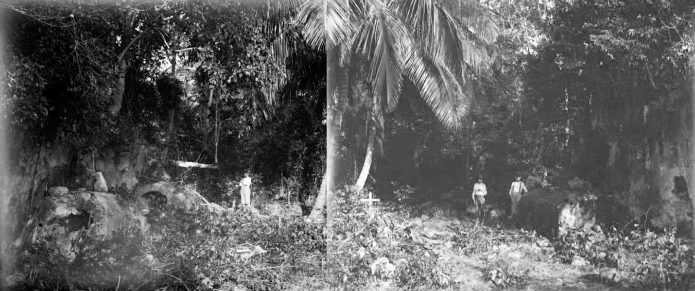
Above: Two photos I pasted together that were taken by Nusbaum of the inside of the 16th century church on Cozumel in 1913. The roof had fallen in, the front wall was gone, and the barrel-shaped tombs inside had been looted, although he reported skeletons were still present. Other graves had been dug into the floor after the church was abandoned in the 1600s. You can see the 20-foot high walls of the sides of the church on either side of the photo. Photos, Palace of the Governors, NM.

You can read more about my search for this church and the search’s results in my books, The True History of Cozumel Volume 1 & 2, available on Amazon books here.


2023-01-07T15:37:36+00:00By |Cozumel History|

How Cozumel was formed and first Populated

How Cozumel was Formed and First Populated

Copyright 2016, Ric Hajovsky

The bedrock that lies beneath Cozumel and the Yucatan peninsula is made up of a sequence of shallow-water limestone, some 1,300 meters thick that was deposited between 200 million and 145 million years ago, during the Jurassic Period. This first layer of limestone was later overlain with a second 1,000-meter-thick layer of calcareous marine deposits during the Cretaceous. Still later, another 15 meters was deposited during the Miocene and Pliocene.

Around 66 million years ago, at the same time as the Chicxulub impact, a Horst block was squeezed upwards from between two fault lines running parallel to the east coast of Quintana Roo. Although the upper surface of this block remained below sea level at the time it was extruded, later sea level fluctuations exposed the block and it became what we now call Cozumel Island.

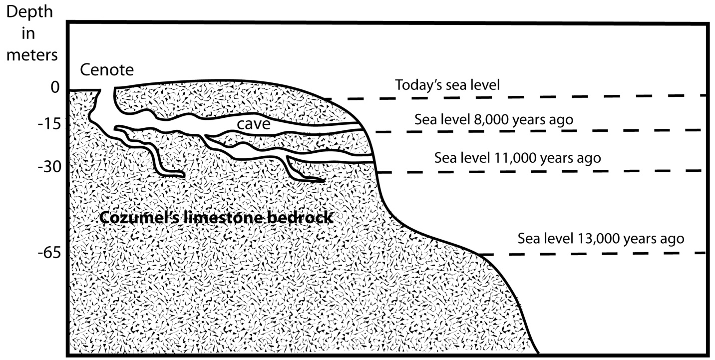
During the Pleistocene, the sea level alternately rose and fell, depending on the amount of the Earth’s water that was sequestered in the glaciers that covered most of Northern America, Europe, Asia and the southern parts of South America and Africa. Twice during this period, the sea level dropped to around 65 meters lower than it is today. That put the surface of Cozumel and the adjacent Quintana Roo coast around 75 meters above sea-level during those ice ages. Throughout the Pleistocene, the rainwater that fell on the Yucatan peninsula and Cozumel percolated through the exposed, porous limestone, dissolving cracks and fissures that enlarged over millennia into deep caves and caverns.

Above: Chart showing the sea level rise over the last 13,000 years on Cozumel.

Later, during the Pliocene, the ice sheets retreated and the sea-level rose, flooding these dry caves and turning them into the water-filled anchialine caves and cenotes we have today. Recently, cave divers have been discovering the skeletal remains of extinct Pleistocene fauna (Saber-toothed tigers, New World horses and camels, and mammoths, among many others) in these now-flooded Yucatecan caves and caverns, as well as early human skeletal remains. In 2001, German Yañez found several bones from the extinct North American horse, Equus conversidens, in the Sifa cenote near Chankanaab Park.

The question often arises, “When was Cozumel first inhabited?” So far, no archaeological evidence has been uncovered that could firmly establish a date earlier than the Pre-classic (or Middle Formative period) some 3,000 years ago. However, there is no reason to discount the possibility that small groups of the Paleo-Indians who had been migrating south from the Bering Strait may have visited Cozumel or even established themselves temporarily as early as 14,000 years ago. Remains of these early New-World colonizers are just now beginning to turn up in the deep cenotes of Quintana Roo. The skeletal remains of the Paleo-Indian “Eve of Naharon” that was recently discovered in the Naranjal cave system near Tulum has been carbon-14 dated to 11,600 B.C., over 13,600 years ago. The 10,000-year-old remains of the Paleo-Indian “Mujer de La Palma” and the child “Joven de Chan Hol” that were found near Tulum in Las Palmas cenote and Chan Hol cenote are just a few of the other finds that have pushed back the timeline for the population of Quintana Roo.

These Paleo-Indians were only the forerunners of the human migration southward in the Americas. By 8,000 years ago, Archaic period hunter and gatherers had populated Yucatán. Shortly thereafter, groups of these early settlers migrated out from northern Quintana Roo to settle the western portion of the Antilles and become the Casimiroid culture in Cuba, Puerto Rico, Hispaniola and other Antillean islands.

Around 4,500 years ago, during the Early Preclassic period (also known as the Early Formative period), the very beginnings of the Maya civilization began to coalesce and become what we now call the Proto-Maya. Within a few hundred years, these Proto-Maya begin to farm corn and their settlements become more permanent in nature. By 1000 B. C., or 3,000 years ago, the Maya culture had evolved into what we now call the Middle Preclassic or Middle Formative period. The earliest dateable artifacts on Cozumel are from this period.

2022-12-26T18:12:24+00:00By |Cozumel History, Maya History|

The Slave Trade in Cozumel


COZUMEL AND THE SLAVE TRADE

Copyright 2011 Ric Hajovsky

The frequently heard statement that Cozumel was abandoned in the 1700s due to predations by bands of roving pirates is nearly true. The island was an easy target for buccaneers and in the mid-1600s the Spanish government finally decided to move the population inland, to towns like Chemax and Xcan Boloná that were far from the marauders’ reach. Some Cozumelenos did, in fact, move to the mainland. However, many stayed on the island and were joined by English dyewood cutters, later known as “piratas.”

Miguel Molas called Cozumel home in 1828, but after he moved away in 1830, a partnership from Merida began a cotton plantation near his old rancho on Cozumel with some 30 convicts from Merida’s prison providing the slave labor. This plantation continued to work until 1841.

Beginning in 1847, during the war of the Castes in Yucatan, more people began to drift back to the island. Seeking a safe refuge from the Mayan rebels that were intent on purging the peninsula of all the Spanish and mixed-blood newcomers, several groups of creoles, mestizos, foreigners, and their Mayan servants soon set up households on Cozumel. They initially found the island a hard place to make a living, but soon enough found a revenue producing commodity; captured Mayan rebels they could sell to the Cubans a slaves.

Just how did the island’s population turn from pirate prey to predatory slave traders? The demographics changed. Prior to the Spanish government’s forced resettlement of many of the island’s residents between the years 1650 and 1688, the typical Cozumeleño was a full-blooded Maya Indian. Although the institution of slavery was integral to Maya civilization, the Yucatecan Maya civil organization had undergone immense changes after surrendering to the Montejos and their Spanish soldiers. By the mid-1500s, the Yucatecan Maya were nothing more than the Spaniards’ subjugated labor force and no longer had the power to capture and keep slaves themselves. However, the majority of the later inhabitants of Cozumel, beginning with the fugitive contrabandista and slave trader Miguel Molas in 1828, were either Spanish, creole, or mestizo. They had grown accustomed to the fact that they were the beneficiaries of the trade in human flesh and not the target. Although Mexico abolished slavery in 1829, it was not made illegal in Cuba until 1862. This made it very tempting for the Repobladores who fled to the island to avoid the war on the mainland to take advantage of their distance from the government authorities in Merida and dabble in the trade whenever the chance presented itself. Judging by the few records that still exist, the occasion presented itself pretty frequently.

On November 21, 1849, the government of Yucatan officially recognized the town founded by the group of refugees who settled on Molas’ old rancho as the “Pueblo de San Miguel de Cozumel” and linked it to the municipal government of Tizimín. That same day, José Francisco Rosel, aged 62 and one of the new immigrants from Xcan, was named the island’s first alcalde. The following January, a census was taken of the residents of the island, which counted 307 adults and an unspecified number of children under 12. Of these adults, 9 were from countries other than Mexico: 2 from Cuba, 1 from Spain, 1 from Guatemala, 2 from the US, 1 from Italy, and 1 from Africa. Only 99 of these repobladores were Maya.

In early 1849, Alcalde Rosel submitted a report to the Yucatecan government detailing the number of vessels arriving at Cozumel, along with their cargos and the names of their masters. For the month of January of 1849, the report tallied 10 vessels; 1 American, 1 English, 5 Belizean, and 3 Mexican. Were these all the vessels that called on the port? Definitely not. It seems there was a lively illicit slave-trade going on between Yucatan and Cuba that was using Cozumel and Isla Mujeres as transshipment points and most of these clandestine voyages went unrecorded. A few of these slaving trips, however, did leave behind a record of their deeds. For example, on December 21, 1850, it was recorded by the Captain of the Port of Cozumel that the Cuban vessel Alerta, captained by Francisco Martinez, arrived in Cozumel with an empty hold. This vessel was one of the many that belonged to the Cuban slave-trader Francisco Martí y Torrens, also known in Cuba as Pancho Marti. Pancho Marti held a special concession to fish in Yucatan waters, granted to him by the Yucatecan government. This cover operation was just one of many he used to disguise his slave-trading enterprise that operated in Cuba, Yucatan, the American Gulf Coast, and Africa. It is a pretty safe bet that when Pancho Marti’s boat left Cozumel for the trip back to Cuba, its hold was no longer empty.

Often the facts of a slaver’s voyage were recorded only because of some unforeseen event, as in the case of the 35-foot-long sailing vessel Sol, captained by Feliciano Peraza. It was the same boat that had carried John Lloyd Stevens and Frederic Catherwood to Cozumel 11 years earlier. The Sol sank on May 10, 1852, with a cargo of 9 slaves (described as “servants” in the report of the wrecking event made by Enrique Angulo, the second Alcalde of Cozumel) belonging to a Juan Bautista Anduce. Two of the slaves drowned, but seven made it safely to the shore and freedom. Peraza managed to raise the Sol and he had repaired the vessel by that June, when he returned to Rio Lagartos to pick up more “servants” for Sr. Anduce. After rounding up another group of Maya and securing them aboard, the Sol anchored at Punta Francés in Holbox for the night. The captured Maya took advantage of the stop-over, breaking their bonds, killing Peraza and severely wounding his two deckhands, Pantaléon Rosado and José Carrillo. Rosado was able to sail the boat to Isla Mujeres, where a posse was assembled and sent out to recapture the escaped “servants.”

In June, 1852, another boat lost four “servants” who had escaped when that boat also stopped overnight at Holbox on the way to Cozumel. This same month, the Petrona, captained by Guadalupe Pech, carried 13 Maya to Cozumel consigned to Colonel José Dolores Cetina. A few days later, Manuel Gascas’ Joaquina out of Telchac, struck a reef off Cozumel and sank with an unspecified number of “servants” aboard consigned to Tómas Mendiburu, the owner of a rancho on Cozumel. Before the month was out, the Segunda Antonia, captained by Casiano Cosgaya and out of Sisal, docked at Cozumel with a cargo of 17 Mayans who Pilar Canto shipped to the island from Mérida.

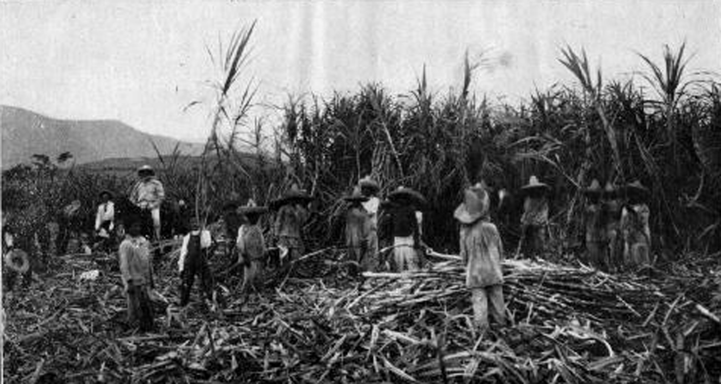
Above: Young Maya slaves working the sugarcane fields in Cuba

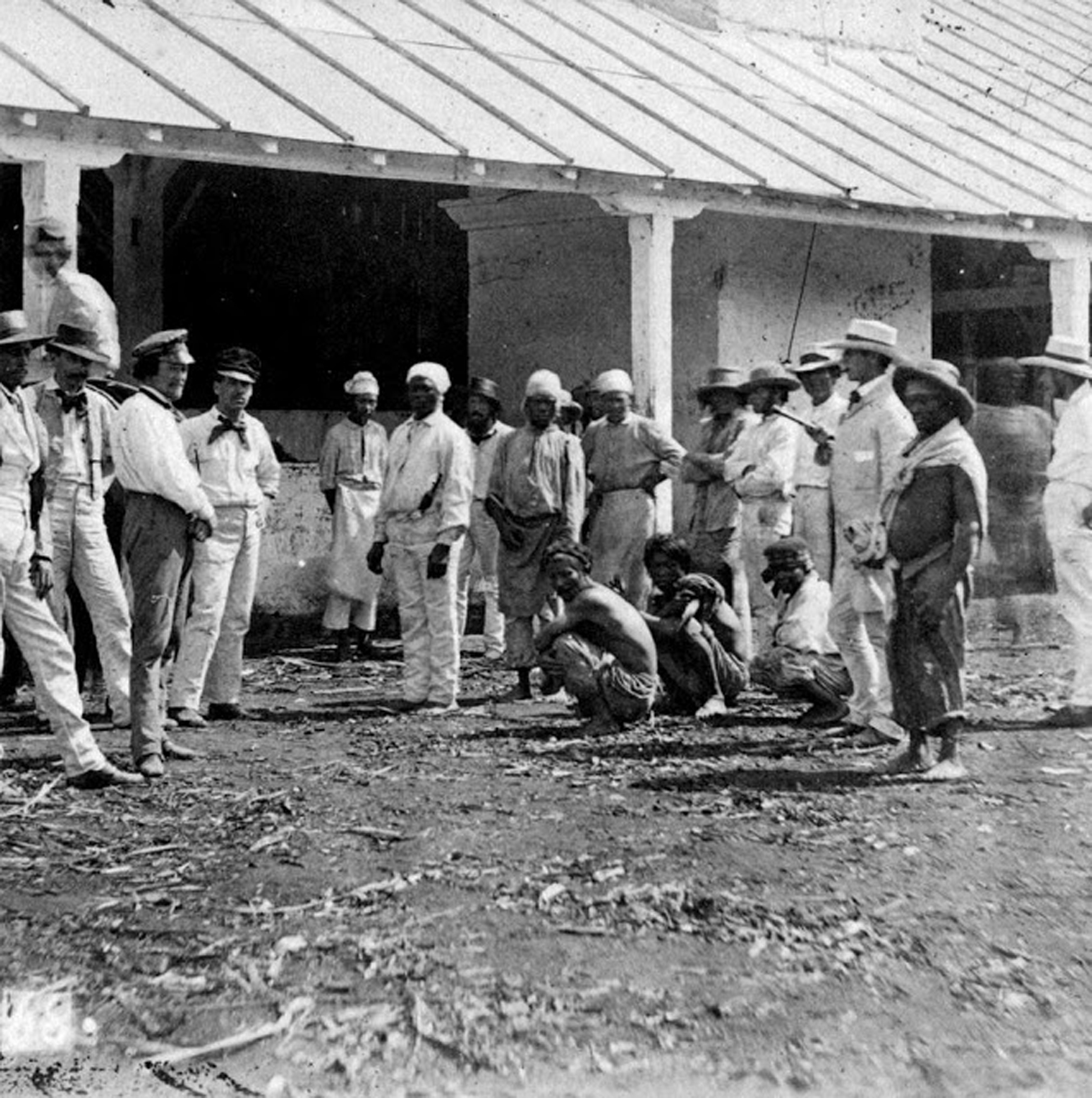
What percentage of the slave trade these few reports represent is unknown, but it is most likely a very small one. The route was well established. The Maya captured in Yucatan were taken first overland to Rio Lagartos and then to Cozumel and Isla Mujeres by sailing vessel. There, the slaves would be held while the slave-traders awaited Cuban “fishing” boats to come to the islands and purchase them. The slaves would then be taken to Cuba inside the fishing boats’ viveros or “live pens” and sold to sugarcane plantation owners.

Not all slave traders got away clean. Juan Bautista Anduce was eventually arrested in Belize by British authorities and was sentenced to four years in prison for shanghaiing Maya rebels near Bahia Asuncion and taking them to Isla Mujeres aboard the vessel Jenny Lind, where they were transferred to a Cuban vessel sent by Anduce’s contact in Havana, Francisco Martí y Torrens. When Anduce was arrested, he still had a letter in his pocket from Martí y Torrens, outlining the deal: 25 dollars for each adult male, 17 dollars for adult females and adolescent males, and eight dollars each for boys under 12 and girls under 16.

Above: Maya slaves being delivered by a ship’s captain to a Cuban plantation owner.

Juan Bautista Anduce was not the only person that we know about who dealt with Martí y Torrens. Luis Luján, former resident of Isla Mujeres and manager of Ranco Santa María in Cedral, had a large stable of “servants” working rancho Santa María and also owned the vessel Josefa, which he used in several dealings with the Cuban slave trader.

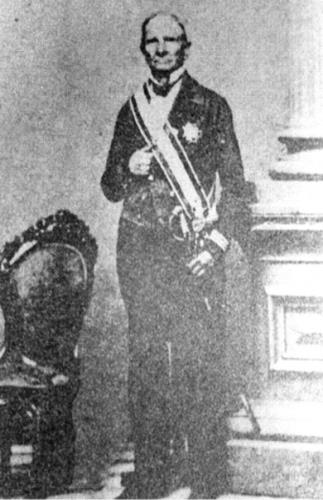
Above: Francisco Martí y Torrens, the Cuban slave trader.

2022-12-11T18:05:28+00:00By |Cozumel History|

Bishop de Landa’s book “Cosas de Yucatan” does not exist!


Diego de Landa’s book, Relación de las cosas de Yucatán does not exist!

Copyright 2015, Ric Hajovsky

Fray Diego de Landa Calderón (1524-1579) was a Franciscan priest born in Alcarreña de Cifuentes, Guadalajara, Spain, who traveled to Yucatan and became the asistente del guardián of Izamal in 1549. In 1552, he was promoted to guardián and in 1561 promoted again to provincial of the province of Yucatan. The following year, De Landa initiated an auto de fé in Maní, Yucatan, in which he famously gathered and burned all the Mayan codices he could get his hands on. The Mayas who were rounded up during the search for evidence that would incriminate them of the crime of continuing to secretly worship the old gods were all severally punished and tortured unmercifully. Many were killed out-right, died during the torture, or committed suicide to escape the torture. When the bishop of Yucatan, Francisco de Toral, heard of these proceedings, he complained about De Landa in a letter to the Spanish king, Felipe II. De Landa, in turn, travelled to Spain in 1563 to defend himself of the bishop’s accusations, which he did successfully and was subsequently acquitted of any wrongdoing. The torture was done in the name of God, after all.

While he was in Spain, De Landa wrote a document outlining his understanding and observations of the Maya culture. He may have planned on using it in his defense, or he may have planned on publishing it, but he ended up doing neither. By 1566, De Landa stopped working on the manuscript. During his stay in Spain, Fray Diego de Landa’s old antagonist, Bishop Francisco de Toral, died and De Landa found himself appointed as the new bishop of Yucatan in 1571. He no longer needed the document to defend his actions in the New World, and the King had recently issued a decree forbidding the publication of books about superstitions and the manner in which the Indians of the New World lived, so that was that.

De Landa carried the manuscript with him back to Yucatan in 1572 and deposited the work in the Franciscan convent in Mérida, Yucatán, for safe keeping, but at some later point the document disappeared. The last mention of the original manuscript was in the Relación de Chunchuchu y Tabi by Pedro García in January 20, 1581.

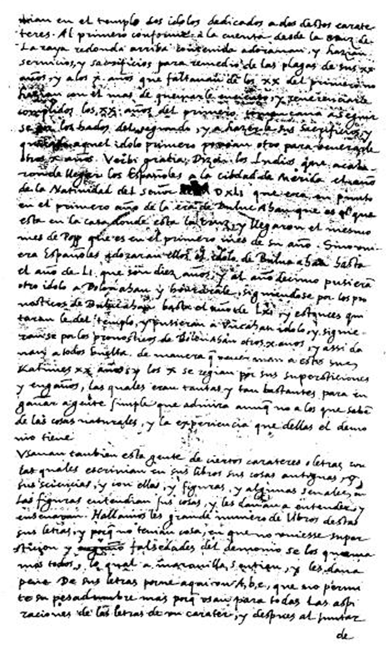
Although De Landa’s original manuscript was lost and never published, a scribe’s abridged copy of a portion of the original manuscript was discovered in 1862, in the Academia de la Historia, in the Royal Library of Madrid, by Abbé Charles-Étienne Brasseur de Bourbourg. This fragment represents an unknown percentage of the original manuscript. It was copied down in 1616 on 66 two-sided leaves plus a map and is the work of three different scribes. Sometime later, the 66 leaves and map were gathered together out of sequence and bound together by a bookbinder. It was then entitled Relación de las cosas de Yucatan, sacada de lo que escribió el Padre Frai Diego de Landa de la orden de San Francisco.

Above: A page from the scribes’ abstract of Diego de Landa’s Relación, as photographed in 1882 by Juan de la Dios de la Rada y Delgado.

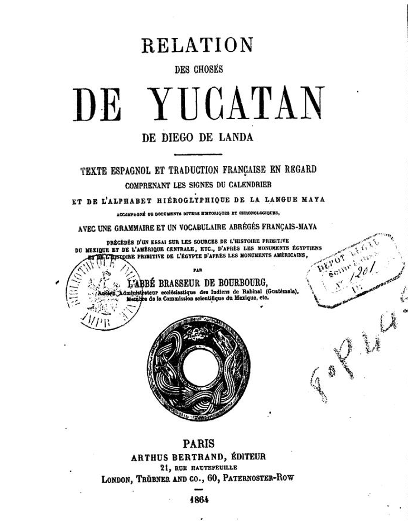
In 1864, Brasseur de Bourbourg transcribed a portion of the Spanish text of the fragment of the copy of De Landa’s manuscript, adding titles and rearranging the order. He then added a French translation to it, which he had Arthus Bertrand publish in Paris as Relation des choses de las cosas de Yucatán de Diego de Landa.

Above: The front piece of the first edition of Relation des choses de las cosas de Yucatán de Diego de Landa.

Since 1864, portions of the fragment of the abstract have been published 14 more times, but few editions include all the text, or all the drawings. For example, William Gates published his version of the abstract in English in 1937, but without many of the original drawings and with the inclusion of many more drawings and notes that were not originally contained in the scribes’ abstract. This work was reprinted in 1978 by Dover Publications. In 1983, Ediciones Dante reprinted the 1938 version by Pérez Martínez, but this Dante version also lacks many of the abstract’s drawings and the pages have been re-shuffled.

The result of all this loss, redaction, copying and reshuffling is that the published versions of the texts that most people have come to believe are faithfully typeset copies of the original Diego de Landa manuscript are nothing of the sort. They are simply copied snippets of copied snippets, rearranged in various orders. The original Diego de Landa manuscript is nowhere to be found, as far as we know, no longer exists.

The Clocktower


The Clock Tower

Copyright 2016, Ric Hajovsky

In 1908, a committee of Cozumel islanders got together and formed the “Centenary Celebration Steering Committee,” to plan for the upcoming Centennial celebration of the 1810 war of independence. The motion of building a commemorative clock tower was passed, and subsequently, plans were drawn up for the construction of the tower.

The building of the tower was accomplished over the course of several weekends in 1910, by Cozumeleños pressed into service via “fagina,” or compulsory, donated labor on public works ordered by the local authorities. Those who didn’t work on the tower were fined by the city, but allowed to pay their fines “in kind” with cal, stones, or other building material. This work was supervised by Hipólito Vivas Rejón, who was rumored to have paid 60 pesos of his personal funds towards the clockwork machinery, (a considerable sum back then) although I personally feel that these were actually city funds that he had access to through his position in the city government at the time. The first stone of the tower was laid on April 2, 1910, when the population of San Miguel was a whopping 822 souls.

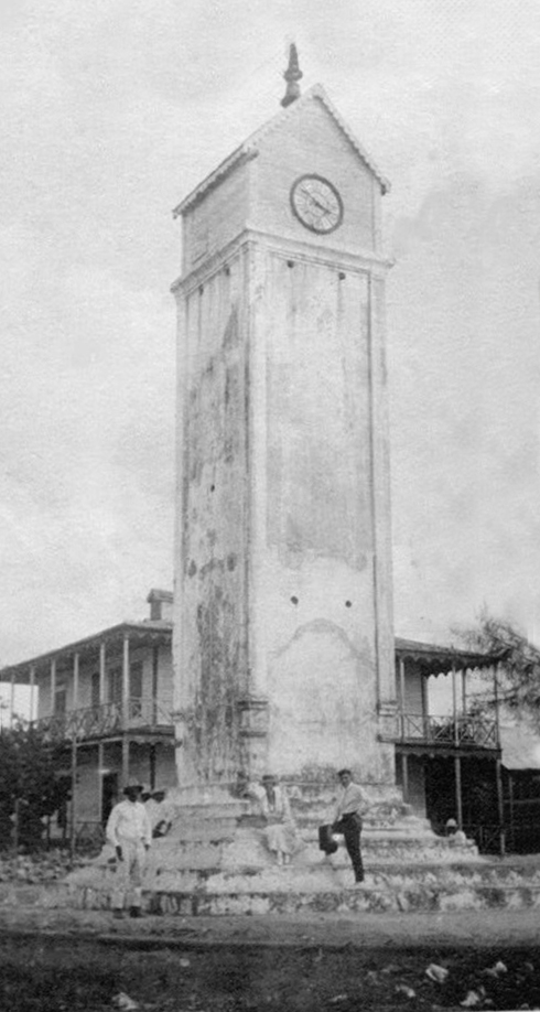
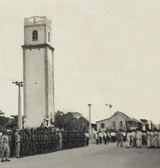
Above: The clock tower in 1922. The original top was of wood. The old City Hall is in the background, on 5th Avenida. The clock faced towards the water.

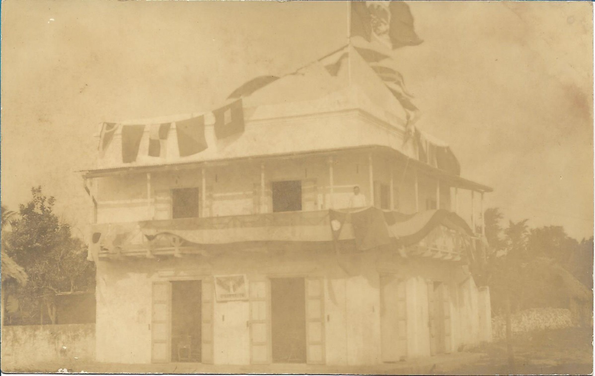
Above: The Coldwell house on the northwest corner of Juarez and 5th Avenue, decorated for the 1910 celebrations. Negociación Joaquín now stands on that corner.

The clock tower was inaugurated on September 15, 1910, when the presidente municipal of Cozumel, Óscar Coldwell Anduze, performed the traditional “Grito de Dolores” from the adjacent ayuntamiento building (where today’s Plaza del Sol resides). The clockwork, however, was not present for the inauguration; it had not been delivered to Cozumel in time.

The original clockwork (now housed in El Museo de la Isla) did not arrive until 1911. It had been ordered from France by the jewelry, watch, and clockwork company La Esmeralda Hauser, Zivy & C °. This company had showrooms in Mexico City and Paris. The Mexico City showroom was the finest in Mexico at the time and was located on the corner of Isabel la Católica and Madero in Mexico City. Today, the Esmeralda building is the Museo del Estanquillo.

The idea that Presidente Porfirio Díaz had something to do with the clock tower and clockworks sprang from the fact that the same company that provided the clockwork to Cozumel (La Esmeralda Hauser, Zivy & C °) also provided Díaz with a very famous pocket watch, nick-named “La Esmeralda.” This pocket watch is now in the Girard-Perregaux Museum in Villa Marguerite, La Chaux-de-Fonds, Switzerland. A image of that pocket watch is below:

The original, wooden, clock housing at the top was replaced with a mamposteria version several years later, sometime after 1923.

Above: Looking north at the clock tower in the 1940s. Back then, the clock still only had one face and it faced the sea.

In 1981, the original clock’s mechanism was replaced with new clockworks and three more faces were added to the tower. The original clockworks are now housed in the Museo de la Isla.

2022-11-30T20:38:50+00:00By |Cozumel History|

Casimero Cardenas and the Cedral Fair

Casimiro Cárdenas and the Cedral Fair

Copyright 2022, Ric Hajovsky

Some websites say that Casimero Cárdenas founded Cedral. Not true. Cedral was a center of population on Cozumel ever since pre-Hispanic times when the village was called Oycib. During the 1500’s, there were more people living in Cedral (by then called Santa Maria de Oycib) than there were in Xamancab (today’s San Miguel). Later, palo de tinto (dyewood) woodcutters from Belize also had dwellings in Cedral. Casimiro, on the other hand, first settled down in San Miguel, not Cedral. He and his wife show up on the 1850 census of the town of San Miguel, a census which did not include residents of Cedral or the outlying ranchos. Casimiro didn’t move from San Miguel to Cedral until after 1850.

For some time now, around the first of May each year, the village of Cedral on Cozumel has celebrated the “miraculous salvation” of Casimiro Cárdenas. The legend at the root of the Cedral Mayfair is the claim by Cárdenas’ family that he was saved by a miracle during a massacre at the church in Saban, Yucatán, during the War of the Castes. According to the family story, he was in the church with a crowd of other residents of Saban when the Maya Cruzoob rebels attacked. Everyone in the church was killed except him, because he was able to hide underneath a pile of dead bodies and evade detection. The family lore says he attributed his good luck to the fact that he was clutching a small, wooden cross; so he swore that if he escaped Saban alive, he would celebrate his salvation every year with a novena (nine consecutive days of prayer) in honor of the cross. And so, says the legend, when Cárdenas found safety in Cozumel with the rest of the Repobladores de 1848, he settled in Cedral and began the yearly tradition of holding a novena in honor of the cross for his good luck.

Today, Cedral’s May celebration (now named the Feria de Cedral) includes much more than just the novena and a religious celebration on the third of May; horseraces, bullfights, drinking and dancing have all been incorporated into the commemoration. One of the most iconic of the dances performed at the Cedral fair is the Dance of the Pig’s Head, a bastardized version of the ancient Yucatec Maya ceremony also known as Pool kekén, Okosta Pool, or K’u’ Pool, in which a pig’s head has been substituted for a sacrificial deer’s head.

A big part of the May celebrations at Cedral is the third of May’s Catholic feast day of the “Finding of the Holy Cross,” one of several days the Catholic Church once observed in regards to the “True Cross.” It destablished was to commemorate the finding by Saint Helena of what she believed to be the “True Cross” in the year 355 AD. This feast day, however, was removed from the liturgical calendar of the Catholic Church by Pope John XXIII in 1960, in order to reduce the number of major feasts and to focus devotion to the Holy Cross on September 14. This abolishment of the “Feast day of the Finding of the Holy Cross” was something that was a long time in coming. As far back as 1691, the Holy Inquisition was expressing its concern over the May 3rd celebration. The religious court in México complained that the celebrations were held in “indecent locations, and the celebrations with Mass, sermon, and processions were mixed up with farces, bullfights, and masquerades on the pretext of honoring the cross, which results in serious scandal.” Mexicans were loath to give up the feast day, however, and the Mexican bishops pleaded for and received an exception, so now México is the only country in the world where Catholics still celebrate May 3rd as a feast day.

This all makes for a good party, but what are the facts behind the story of Casimiro Cárdenas that this fiesta celebrates?

First, the records show that Casimiro Cárdenas Sanguino was born in 1820 in Tizamín, a town 89 miles north of Saban. The records also show that he married Vitoria Tapia Alvarez of Tihosuco, a town 20 miles north of Saban. There are no surviving records of any type associating Cárdenas with Saban in any manner.

Second, in the January 1850 “Padrón que comprende todos los hombres que forman el Pueblo de San Miguel en la Isla de Cozumel” (Census comprising all the men who formed the village of San Miguel on the island of Cozumel), Casimiro Cárdenas is listed as a 28-year-old male resident of San Miguel. Residents of Cedral and many outlying ranchos do not appear in the census. However, some of these non-San Miguel residents appear in other 1850 letters and documents, such as Luis Lujan, who shows up in a February 1850 letter from Alcalde José Francisco Rosel, listing Lujan as the “dueño o personero del Rancho Santa María de esta jurisdicción, ubicado en esta misma isla a distancia de unas tres o cuatro leguas” (owner or representative of Santa María Ranch, located in this same island at a distance of three or four leagues). Lujan’s uncle, Luis Borja, alsoappears as a non-resident of San Miguel and living near Cedral. Rosel was complaining in the letter to the governor that some people, like Lujan, were refusing to contribute labor to the village of San Miguel because they said they lived too far away.

Third, the census states that Cárdenas was a laborer from Tihosuco, presumably because that is where he was living with his wife when they moved to San Miguel. He is listed as a Hidalgo, which in that day and age meant a Maya or part-Maya who was on the Yucatan Government’s side of the War of the Castes and fighting against the Cruzoob rebels. Cárdenas’ wife, Vitoria, is also listed in the “Padrón que comprende todos las mugeres que forman el Pueblo de San Miguel en la Isla de Cozumel” (Census comprising all the women who formed the village of San Miguel on the island of Cozumel), as a 20-year-old, white molendera (corn grinder) from Tihosuco.

Fourth, although records show that Saban surrendered to the Cruzoob in late 1847, there is no record of a massacre having occurred there at that time. The church at Saban was used later as a redoubt by the Yucatecan government forces from January 17, 1848 until they abandoned Saban to the Maya Cruzoob in August, 1848. There is no record of a massacre at Saban prior to the one that happened there in 1853, three years after Cárdenas and his wife appeared as residents of San Miguel on Cozumel.

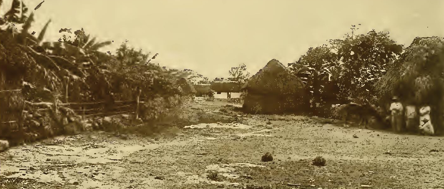
Above: Photo of Cedral taken sometime prior to 1910.

2022-11-12T15:55:32+00:00By |Cozumel History|

Prehistoric Cozumel


Prehistoric Cozumel

Copyright 2022 Ric Hajovsky

During the last ice age twenty-thousand years ago, prehistoric Cozumel looked much different than it does today. I‘m not talking about the manmade changes; I’m talking about the shape and geography of the island itself.

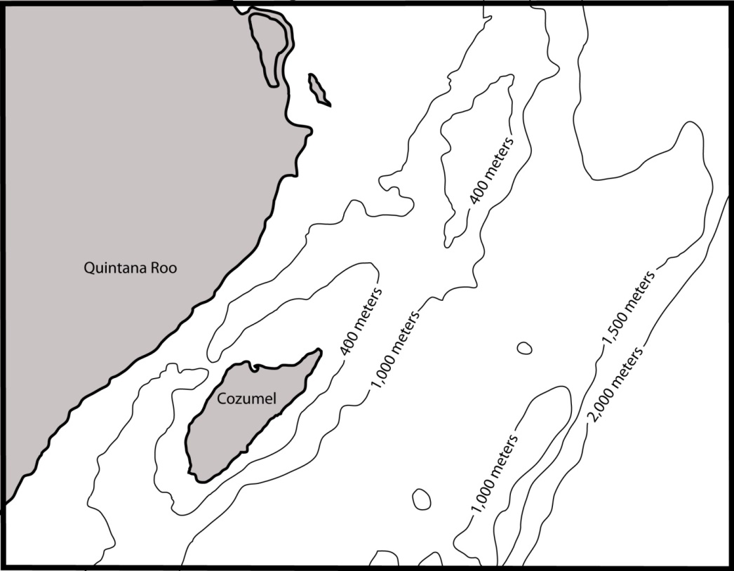
For one thing, the sea level twenty-thousand years ago was 400 feet lower than it is today. That means the outer edge of the underwater shelf (what today’s divers call “the wall”) surrounding Cozumel and separating its coastal shallows from the 3000-foot-deep channel lying between the island and the mainland was a dry cliff-face back then. If you were standing at the edge of this sheer cliff twenty millennia ago, the surface of the ocean was a dizzying 300 feet below. That is as far as the surface of the ocean is from the top of the Statue of Liberty’s torch today.

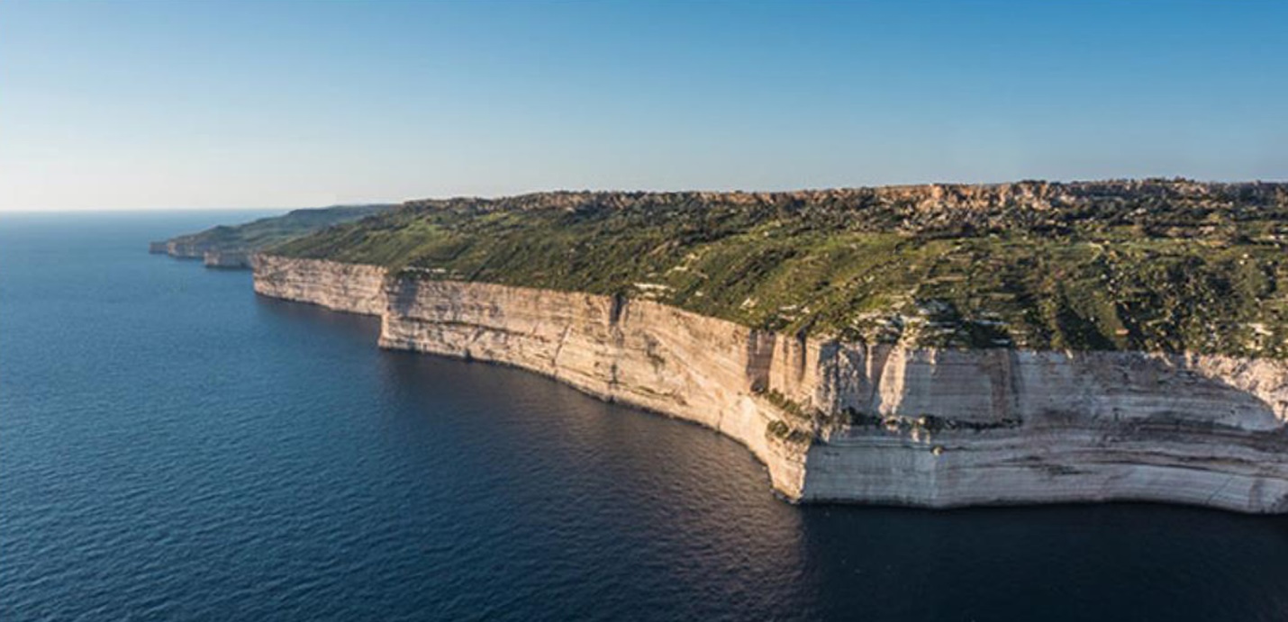
The highest point on Cozumel now is only around 45 feet above sea level. But back then, if you looked out across the water from the mainland at Cozumel, it wouldn’t look like the low-lying blip on the horizon you see today. The island would have stood almost 450 feet above sea-level, a massive block of limestone standing proud of the sea, similar to the image below:

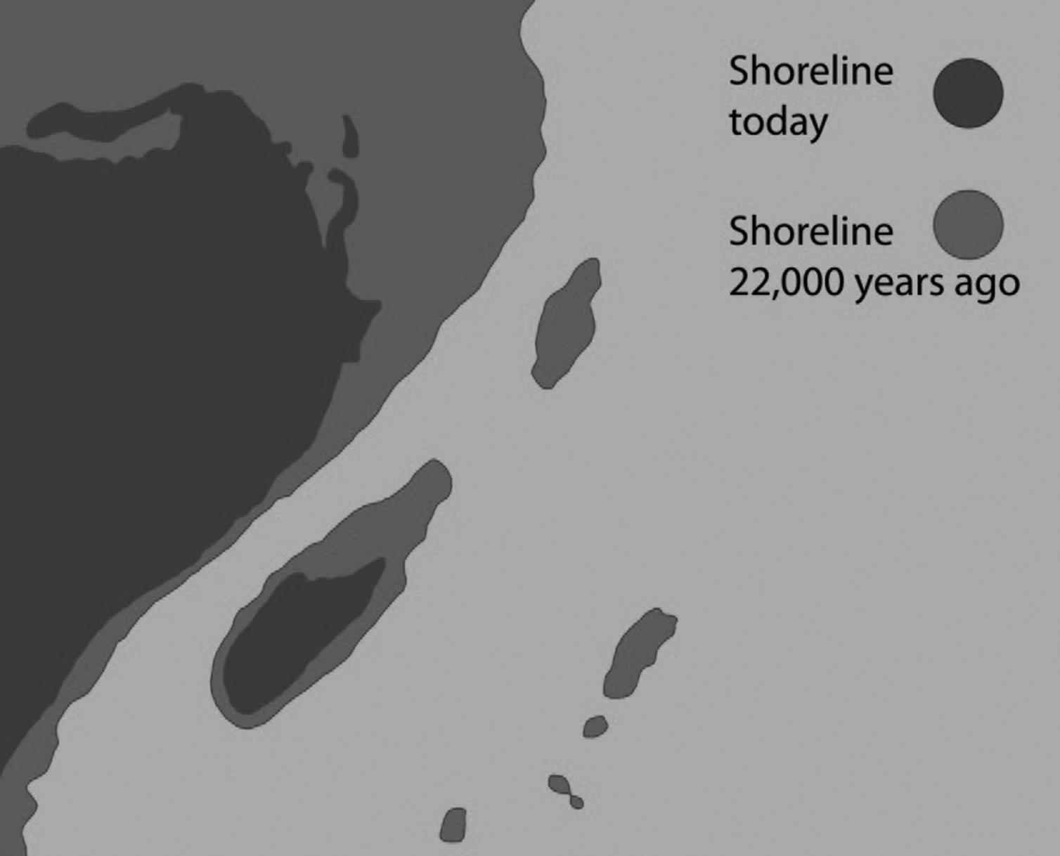
Cozumel was not just higher back then, it was longer and wider. The sea has since risen and covered the shoulders of the island that sloped towards the once-dry cliffs, just as the sea now covers all the flatter area north of the island. Not only that, but Cozumel wasn’t the only island in this area. At least six other islands were scattered around nearby that are now just underwater seamounts.

Above: A comparison of Cozumel’s shore line today versus 22,000 years ago.

Above: The sea depths surrounding Cozumel today.

The island has been higher than sea level for the last 125,000 years. During that time, it was populated by many different types of plants that drifted to its shores as well as seeds blown in by the wind or carried by birds in their guts. Some of the plants that were NOT found on the island prior to the arrival of the Spanish in 1500s were: Coconuts, plantains, bananas, oranges, limes, and lemons. Other latecomers were the royal palm, the tall Australian pine, and the red-flowering flamboyán tree, which didn’t show up until the twentieth century.

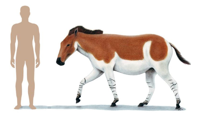
Animals also were carried on currents or swam to Cozumel. Birds and bats flew to the island. These pioneer animals not only included the kinds we see on Cozumel today, but a few species that are now extinct, like the Pleistocene Era equine, Equus conversidens. The fossil bones of one example of this 11,000 to 12,000 year-old equine were discovered in the Sifa cenote in Cozumel. Sifa is one of the more than ten cenote openings that are connected to the La Quebrada underwater cave that has its sea outlet at the south end of Chankanaab Park. I mapped and excavated part of this underwater cave in the 1980s, excavating and conserving several Maya ceramics and pieces of carved jadeite that are now stored in the Mexico City Museo de Antropología e Historia.

Above: A six-foot tall man in comparison to the extinct Equus conversidens (also known as the American onager).

There are similar cenotes on the mainland where divers found more remains of extinct prehistoric animals, including the charred and butchered bones of a camelid (Hemiauchenia macrocephala), bones of giant ground sloths showing cut-marks, giant cave bears, saber-toothed tigers, mastodons and more. Scuba divers on the mainland also discovered skeletons of more than ten Paleo-Indians who died in the caves 10,000 to 13,000 years ago, before the caverns were flooded. So far, no early human bones have been found in Cozumel’s flooded caves and cenotes, but one day the skeleton of a Paleo-Indian will probably turn up. If a horse could make it to Cozumel, obviously Indians could. We know these guys were venturing out from Yucatan and Quintana Roo to populate the western portion of the Antilles by 8,000 BC., later becoming what we now call the Casimiroid culture. If they could get to Cuba and Jamaica from Yucatan, they should have had no problem crossing the channel to Cozumel.

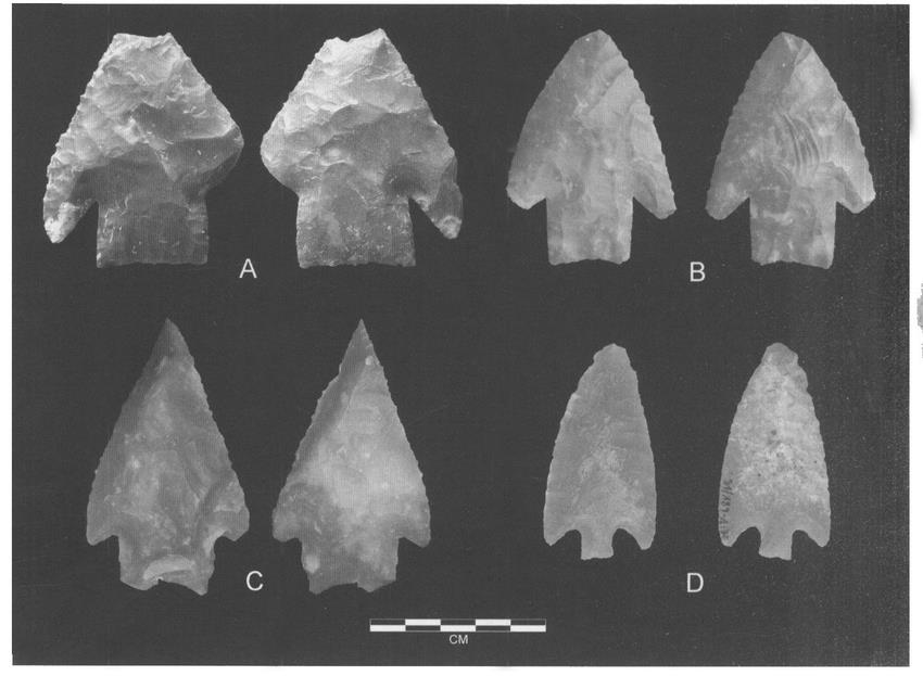
These Paleo-Indians would not have made much impact on Cozumel Island and left little to show they had ever been here: Hearths from seasonal campsites and debitage from flint nappers making their early archaic-type, chert projectile points. They made no ceramics, so that artifact is absent from the archaeological record.

Above: Archaic points found in Belize. Photos by Jaime Awe.

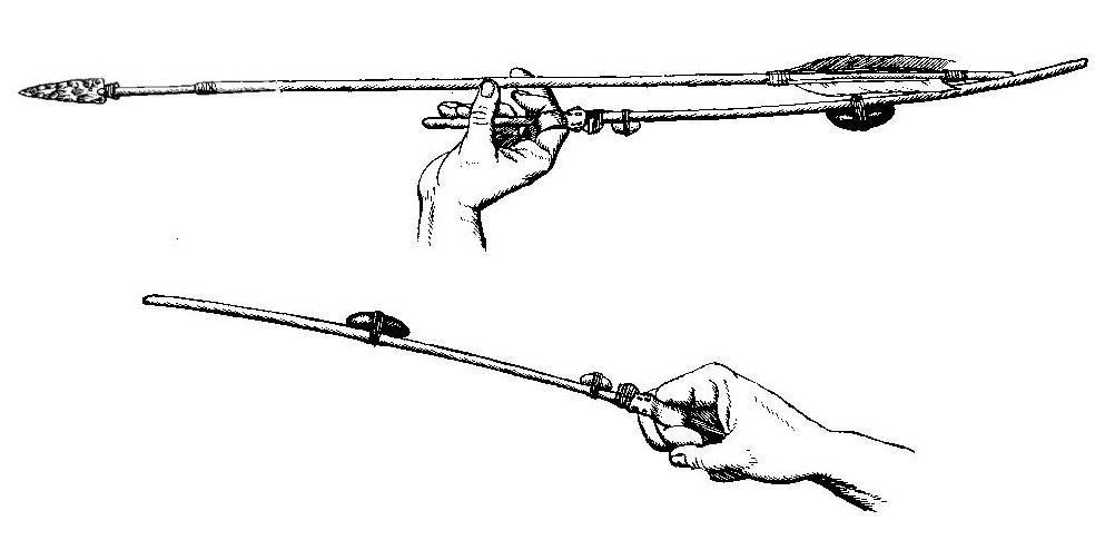
Above: The chert projectile points were used to tip atl-atl (spear-thrower) darts, not arrows. The Paleo-Indians didn’t have bows and arrows.

Beginning about 11,650 years ago, during the Holocene Epoch, the ice sheets in the northern and southern hemispheres retreated and the sea-level rose, flooding the dry caverns on Cozumel and turning them into the water-filled anchialine caves and cenotes. When these caves filled up with groundwater from the rising water table, the percolating rainwater was no longer able to evaporate and deposit its calcium carbonate load, so the speleothems stopped growing when they were submerged. Today, scuba divers are exploring these underwater caves. But, when the freshwater table and sea level were lower until about 11,500 years ago, Cozumel’s caves were dry and any animal or Indian could enter in search of drinking water in pools at the bottom of the cave.

Nine hundred kilometers from the Quintana Roo coast, between Cozumel and the Caiman Islands is the Caiman Trench. This deep trench in the seafloor was formed by the subduction zone where the North American tectonic plate meets the Caribbean tectonic plate. Sometime shortly after 450 A.D., these two plates shifted creating a large undersea earthquake. The earthquake, in turn, generated a series of tsunami waves over 15 feet (4.5 meters) high. These tsunamis washed over coasts of the island of Cozumel, and then struck the Quintana Roo coast along a 150 mile (250km) long swath. The giant waves threw up a berm of boulders, coral, and sand sixteen feet high all along the Quintana Roo coast as far as 1200 feet (365 meters) from the beach.

2022-11-06T18:18:30+00:00By |Cozumel History|

Cycling towards Armageddon


Cycling towards Armageddon

Copyright 2012, Ric Hajovsky

I recently received a request from a local editor for an article based on the theme “A New Cycle” and thought it might be interesting to write something on the subject, especially since I am in need of one. Mine was stolen recently; just one more of the dozens of bicycles that disappear here on the island every month. Where they all go and how they get there is anybody’s guess. I guess I should be grateful that car-theft is not the problem here as it is elsewhere. But then again, a fly buzzing around in tight circles inside a bottle comes to mind when I think of car-theft in Cozumel.

After some more thought, I realized that the kind of cycle the editor was most likely asking for was some kind of feel-good article about fresh starts or new beginnings. I guess if I had to write about that kind of cycle, it would probably be about something like the ancient Mayans’ B’ak’tun 13 and their supposed “end of the world prophesy,” an event some say we can look forward to on December 21, 2012. [Spoiler alert!! It didn’t happen. I wrote this article in early 2012] Although I’m not taking the prediction seriously, many folks are. I read in the news that our own [now defunct] MayAir airline has decided to promote 2012 as the “Year of Catastrophe,” the wisdom of which I question. I’m sure there will be a slight increase in new-agers traveling to the Mayan Riviera in December, but whether or not that will have much of an impact on Cozumel’s economy, I can’t say. I suppose the really serious new-agers will be flying in on one-way tickets and maxing out their credit cards while they are here. That could give us a slight bump, I guess, but when December 22 rolls around and they wake up to a bright new day instead of being reborn into a bright new millennium, the credit card companies may be receiving some frantic calls disputing some of their most recent charges.

I got to looking into this idea of an impending apocalypse and realized that, just like so many of the doomsayers that came before, these eschatologists (those who study when the end will come; not to be confused with scatologists, those who study what comes out of our ends) have it completely wrong. The Mayans never predicted the end of the world, just the end of their calendar’s cycle. That was because, unlike today’s modern perpetual calendar, theirs had both a starting date and an ending date.

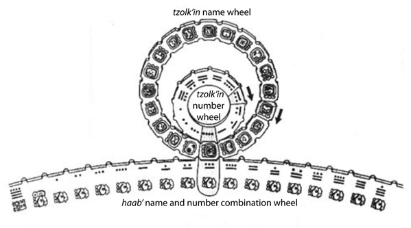
We’ve all seen the mechanism that looks like a geared wheel-within-a-wheel riding along the outside of a third, larger geared wheel, which the Mayans used to form their uniquely-named dates. This mechanism, called the Calendar Round, was made up of Tzolk’in calendar (which has a 260 day year and is the pair smaller wheels) and their Haab’ calendar (with a 365 day year and is the larger wheel that the Tozolk’in pair ride along). By rotating the wheels by one gear tooth every day and noting the names of the three aligned gears, priests would assign a three-part name to each new day for 52 years. After that, the Calendar round started repeating itself.

Mayan Calendar

Above: The Maya Calendar Round, made up of the Haab’ (365 day year) and Tzolk’in (260 day year) calendar wheels

To record dates that occurred farther back (or forward) than that 52-year-period, they needed a different way to assign a unique identifier to a specific date. The solution they came up with is called the “Long Count.” Instead of geared wheels, the Long Count system was actually more like the drive gear wheel of an army tank running along a broken tread. When the drive gear reaches the loose end of the tread, it goes off the track and into the mud. The Mayan Long Count calendar reaches the end of the “tread” every B’ak’tun (a period of 394.3 solar years), then needs to be reset and put back at the beginning of its broken tread. So far, it’s been reset 13 times; hence our current period, B’ak’tun 13.

Between the years 1905 and 1935, archeologists J. T. Goodman, J. H. Martínez, and J. E. S. Thompson made some calculations, based mostly on a Spanish scribe’s text written in 1539, that put the start date of the Mayan calendar at August 11, 3114 BC. So, if you use their correlation of the Mayan Long count to our Gregorian calendar (or the G.M.T. correlation, as it has come to be called, not to be confused with Greenwich Mean Time) to determine the Long Count’s start date, the next “end-of-the-tread” date is December 21, 2012. I guess the Mayan i-tech who originally designed their calendar was a lot like the whizz-kids who designed our old computer software to only recognize the last two digits in a year’s date. Remember Y2K? Short sighted at best. But then again, I can’t remember the last time I saw anyone here in Quintana Roo write out a check using a date in the Mayan Long Count, so maybe the fact it will come to an end is not really all that important. The only guys I figure it will actually affect are the silver-trinket hustlers on the square in Merida. They all will need to tweak their sales pitches. The last time I was there, one of them approached me and tried to sell me what he insisted was a silver replica of the Mayan “perpetual” calendar. “Why,” I asked him at the time, “would I want to buy a perpetual calendar that will only work for a few more months?”

When the current B’ak’tun number 13 comes to its end, I guess we could wind the Mayan clock “back to one,” and start it up again for another 394.3 years, but what’s the point? It may be better if we all here on Cozumel just climb on MayAir’s bandwagon and start advertising things like a “Have your Last Supper at Las Palmeras,” or “When the Rapture comes, enjoy it 130 feet down with Rapture of the Deep Divers!” Who knows? Maybe we could lure more of those end-time travelers into spending their money here.

However, as interesting this new advertising gimmick may be, I have some bad news. The G.M.T. correlation has recently (three years ago, but that’s a blink of an eye in Long Count time) been called into question. Dr. Andreas Fuls, an archeoastronomer of the Technical University of Berlin, believes that the Mayan’s celestial-mechanical calculations of the orbit of the planet Venus (as well as their records of eclipses, conjunctions, maximum elongations, and heliacal aspects) depicted in the 900 year old Dresden Codex (one of only three Mayan books to have survived the Spaniards book-burning during the inquisition) do not coincide with the G.M.T. start date of 3114 BC, but rather push the whole Long Count forward another 208 years! I guess that means that now we have until 2220 to promote the coming of Armageddon.

2022-10-29T17:26:25+00:00By |Cozumel History|

Connecting Capote, Cozumel, and the Killers of the Clutters

Connecting Capote, Cozumel, and the Killers of the Clutters

Copyright 2012, Ric Hajovsky

In 1959, Truman Capote read a story in the New York Times about the murders of the Clutter family and immediately began to write a book about the killers. It took him five years to finish writing it. He published his story first as a four-part series of articles beginning with installment number one in the September 25, 1965 edition of the New Yorker magazine under the title In Cold Blood: The last to see them alive. The book, In Cold Blood, was published immediately afterwards in 1965 by Random House. The book was made into a movie by the same name in 1967.

In the English version of the book, Capote writes that Perry, one of the two murderers portrayed in the story, read a men’s magazine article about Cozumel and fantasizes about going to the island. The article, Capote quoted in the book, was supposed to have said you could “shed your clothes, put on a relaxed grin, live like a Raja, and have all the women you want for $50-a-month!”

Capote then added: “From the same article he had memorized other appealing statements: ‘Cozumel is a hold-out against social, economic, and political pressure. No official pushes any private citizen around on this island,’ and ‘Every year flights of parrots come over from the mainland to lay their eggs.’”

Later in Capote’s book, Perry fanaticizes performing on stage and he composes a ballad which he sings for his companion, Dick:

“Every April flights of parrots
Fly overhead, red and green,
Green and tangerine.
I see them fly, I hear them high,
Singing parrots bringing April spring…”

Truman then writes: “Dick, on first hearing the song, had commented, ‘Parrots don’t sing. Talk, maybe. Holler. But they sure as hell don’t sing.’”

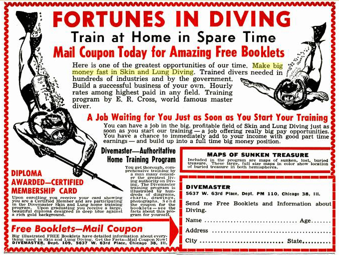
Truman says that Perry had often dreamt of going to such a place as Cozumel for adventure and since childhood had been sending off for literature that touted “Fortunes in Diving!” Train at Home in Your Spare Time. Make Big Money Fast in Skin and Lung Diving. Free Booklets…” Truman also writes that Perry was frequently answering advertisements like the one that said “Sunken Treasure! Fifty Genuine Maps! Amazing Offer!”

Above: The ad in Popular Mechanics Magazine January, 1959.

Capote has a scene in the book where Perry is planning a get-away trip to Mexico while sitting at a table in a diner and looking at a Phillips 66 map of Mexico that has Cozumel, Acapulco, Sierra Madre, and other places circled in red. Later, Perry and Dick drive their car to Mexico. They enter Mexico at Nuevo Laredo, stay their first night in San Luis Potosi, and then drive to Mexico City. After staying in Mexico City for a while, they drive to Cuernavaca, Taxco, and Acapulco. Finally, they drive back to Mexico City, sell the car, and take a bus back to Barstow, California. The closest they ever got to Cozumel was Mexico City.

Truman, however, DID eventually make it to Cozumel. He talked about his experience there in a September, 1975 interview with Richard Zoernik for issue number 3 of Playgirl magazine:

“Never rent a house in Cozumel sight unseen,” Truman Capote intoned, punctuating the warning with a giggle as he sat slumped on a dark leather banquette in the crowded smoked-filled cocktail lounge of the Hotel Carlyle in New York. Capote was tired. He had just returned from Cozumel, an island off the coast of Yucatan, where he paid his first visit to the house he had rented for the summer with his close friend and almost constant companion, Lee Radziwill and her sister Jackie Kennedy Onassis.

“They said the house was secluded,” Capote continued, straightening in his seat, sipping his screwdriver and peering at me from behind rose tinted lenses. “Oh, was it ever secluded all right!” Capote, growing more animated, made his mouth go rubbery, like a hand puppet’s, and dragged the guttural stresses from the corner of his lips. His famous laugh began in short staccato bursts. “So is Devil’s Island secluded! The house is on this, kind of, you know, on this bluff that overlooked the ocean. And, there was a clump of palm trees at the edge of the bluff. And, well…”

Capote paused to swallow his laughter. Composed again, he took another sip of his drink, twirled an open palm in the air and continued. “And so Lee and I got there just as it was dark. We got out of the car and there was this… this dark cloud, like some poisonous fog, just kind of hovering in the tops of these trees. And then, it started to move toward us! And… and Lee grabbed my arm and she said, ‘Truman! What is that?’“

Laughing harder now, Capote fought for breath and then began to wheeze. He wadded up a handkerchief in his palm and shoved a part of the fabric up under each rose-tinted lens, drying his cheeks and eyes. “The cloud was mosquitoes!” He jerked his fist-full of handkerchief in the direction of my glass, at the two soggy onions at the bottom of my Vodka Gibson. “Mosquitoes as big as those onions!”

Capote collapsed against the back of the banquette, his laughter erupting above the din in the crowded lounge. His laughter was contagious and soon we were both laughing as others in the room stared at our table.

The episode he was describing took place in March, 1973, when the Onassis’ yacht, the Cristina, anchored in Cozumel for a three week stay, departing the island on March 27. Gloria Guinness later described the end of the visit to the island in the book “Truman Capote”:

“I went with him to that terrible place…Cozumel. The beginning of the end. It’s hard to say when the beginning of the end did start, because it would start and then it would stop, which would make you very hopeful. But he was terribly depressed there, and that was frightening. He was immobilized. Anyway, we got out of Cozumel. I chartered a small plane and got him to the Paleys’ in Nassau. I knew there was a hospital there if necessary.”

In a later letter, Truman himself described Cozumel as:

“Cozumel, Mexico, an awful place Gloria and Loel Guinness rescued me from.”

2022-10-25T16:25:25+00:00By |Cozumel History|
Go to Top