Los Cinco SolesDistinguished Mexican Arts and CraftsClick for more info / Clickea por más información
SkyReef Beach ClubSnorkel, Beach, Bar & GrillClick for more info / Clickea por más información
Pancho's BackyardColonial-style restaurants on Melgar ave. and Puerta Maya PierClick here for more info / Clickea por más información

How Cozumel was formed and first Populated

How Cozumel was Formed and First Populated

Copyright 2016, Ric Hajovsky

The bedrock that lies beneath Cozumel and the Yucatan peninsula is made up of a sequence of shallow-water limestone, some 1,300 meters thick that was deposited between 200 million and 145 million years ago, during the Jurassic Period. This first layer of limestone was later overlain with a second 1,000-meter-thick layer of calcareous marine deposits during the Cretaceous. Still later, another 15 meters was deposited during the Miocene and Pliocene.

Around 66 million years ago, at the same time as the Chicxulub impact, a Horst block was squeezed upwards from between two fault lines running parallel to the east coast of Quintana Roo. Although the upper surface of this block remained below sea level at the time it was extruded, later sea level fluctuations exposed the block and it became what we now call Cozumel Island.

During the Pleistocene, the sea level alternately rose and fell, depending on the amount of the Earth’s water that was sequestered in the glaciers that covered most of Northern America, Europe, Asia and the southern parts of South America and Africa. Twice during this period, the sea level dropped to around 65 meters lower than it is today. That put the surface of Cozumel and the adjacent Quintana Roo coast around 75 meters above sea-level during those ice ages. Throughout the Pleistocene, the rainwater that fell on the Yucatan peninsula and Cozumel percolated through the exposed, porous limestone, dissolving cracks and fissures that enlarged over millennia into deep caves and caverns.
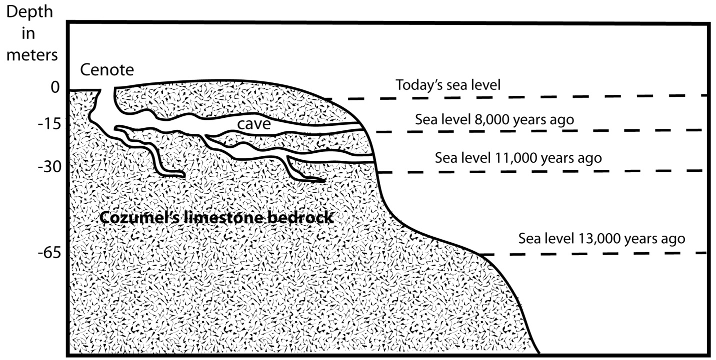
Above: Chart showing the sea level rise over the last 13,000 years on Cozumel.

Later, during the Pliocene, the ice sheets retreated and the sea-level rose, flooding these dry caves and turning them into the water-filled anchialine caves and cenotes we have today. Recently, cave divers have been discovering the skeletal remains of extinct Pleistocene fauna (Saber-toothed tigers, New World horses and camels, and mammoths, among many others) in these now-flooded Yucatecan caves and caverns, as well as early human skeletal remains. In 2001, German Yañez found several bones from the extinct North American horse, Equus conversidens, in the Sifa cenote near Chankanaab Park.

The question often arises, “When was Cozumel first inhabited?” So far, no archaeological evidence has been uncovered that could firmly establish a date earlier than the Pre-classic (or Middle Formative period) some 3,000 years ago. However, there is no reason to discount the possibility that small groups of the Paleo-Indians who had been migrating south from the Bering Strait may have visited Cozumel or even established themselves temporarily as early as 14,000 years ago. Remains of these early New-World colonizers are just now beginning to turn up in the deep cenotes of Quintana Roo. The skeletal remains of the Paleo-Indian “Eve of Naharon” that was recently discovered in the Naranjal cave system near Tulum has been carbon-14 dated to 11,600 B.C., over 13,600 years ago. The 10,000-year-old remains of the Paleo-Indian “Mujer de La Palma” and the child “Joven de Chan Hol” that were found near Tulum in Las Palmas cenote and Chan Hol cenote are just a few of the other finds that have pushed back the timeline for the population of Quintana Roo.

These Paleo-Indians were only the forerunners of the human migration southward in the Americas. By 8,000 years ago, Archaic period hunter and gatherers had populated Yucatán. Shortly thereafter, groups of these early settlers migrated out from northern Quintana Roo to settle the western portion of the Antilles and become the Casimiroid culture in Cuba, Puerto Rico, Hispaniola and other Antillean islands.

Around 4,500 years ago, during the Early Preclassic period (also known as the Early Formative period), the very beginnings of the Maya civilization began to coalesce and become what we now call the Proto-Maya. Within a few hundred years, these Proto-Maya begin to farm corn and their settlements become more permanent in nature. By 1000 B. C., or 3,000 years ago, the Maya culture had evolved into what we now call the Middle Preclassic or Middle Formative period. The earliest dateable artifacts on Cozumel are from this period.
2022-12-26T18:12:24+00:00By |Cozumel History, Maya History|

Bishop de Landa’s book “Cosas de Yucatan” does not exist!


Diego de Landa’s book, Relación de las cosas de Yucatán does not exist!

Copyright 2015, Ric Hajovsky

Fray Diego de Landa Calderón (1524-1579) was a Franciscan priest born in Alcarreña de Cifuentes, Guadalajara, Spain, who traveled to Yucatan and became the asistente del guardián of Izamal in 1549. In 1552, he was promoted to guardián and in 1561 promoted again to provincial of the province of Yucatan. The following year, De Landa initiated an auto de fé in Maní, Yucatan, in which he famously gathered and burned all the Mayan codices he could get his hands on. The Mayas who were rounded up during the search for evidence that would incriminate them of the crime of continuing to secretly worship the old gods were all severally punished and tortured unmercifully. Many were killed out-right, died during the torture, or committed suicide to escape the torture. When the bishop of Yucatan, Francisco de Toral, heard of these proceedings, he complained about De Landa in a letter to the Spanish king, Felipe II. De Landa, in turn, travelled to Spain in 1563 to defend himself of the bishop’s accusations, which he did successfully and was subsequently acquitted of any wrongdoing. The torture was done in the name of God, after all.

While he was in Spain, De Landa wrote a document outlining his understanding and observations of the Maya culture. He may have planned on using it in his defense, or he may have planned on publishing it, but he ended up doing neither. By 1566, De Landa stopped working on the manuscript. During his stay in Spain, Fray Diego de Landa’s old antagonist, Bishop Francisco de Toral, died and De Landa found himself appointed as the new bishop of Yucatan in 1571. He no longer needed the document to defend his actions in the New World, and the King had recently issued a decree forbidding the publication of books about superstitions and the manner in which the Indians of the New World lived, so that was that.

De Landa carried the manuscript with him back to Yucatan in 1572 and deposited the work in the Franciscan convent in Mérida, Yucatán, for safe keeping, but at some later point the document disappeared. The last mention of the original manuscript was in the Relación de Chunchuchu y Tabi by Pedro García in January 20, 1581.

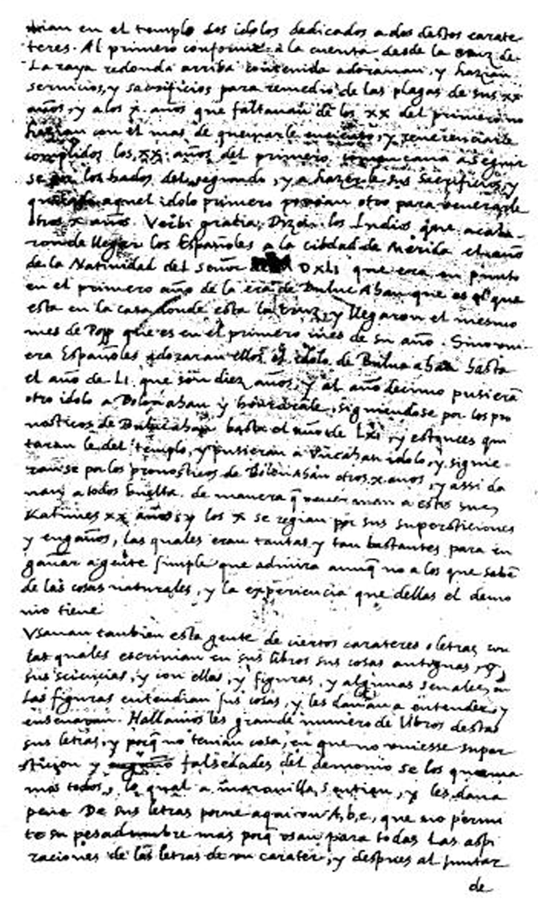
Although De Landa’s original manuscript was lost and never published, a scribe’s abridged copy of a portion of the original manuscript was discovered in 1862, in the Academia de la Historia, in the Royal Library of Madrid, by Abbé Charles-Étienne Brasseur de Bourbourg. This fragment represents an unknown percentage of the original manuscript. It was copied down in 1616 on 66 two-sided leaves plus a map and is the work of three different scribes. Sometime later, the 66 leaves and map were gathered together out of sequence and bound together by a bookbinder. It was then entitled Relación de las cosas de Yucatan, sacada de lo que escribió el Padre Frai Diego de Landa de la orden de San Francisco.

Above: A page from the scribes’ abstract of Diego de Landa’s Relación, as photographed in 1882 by Juan de la Dios de la Rada y Delgado.

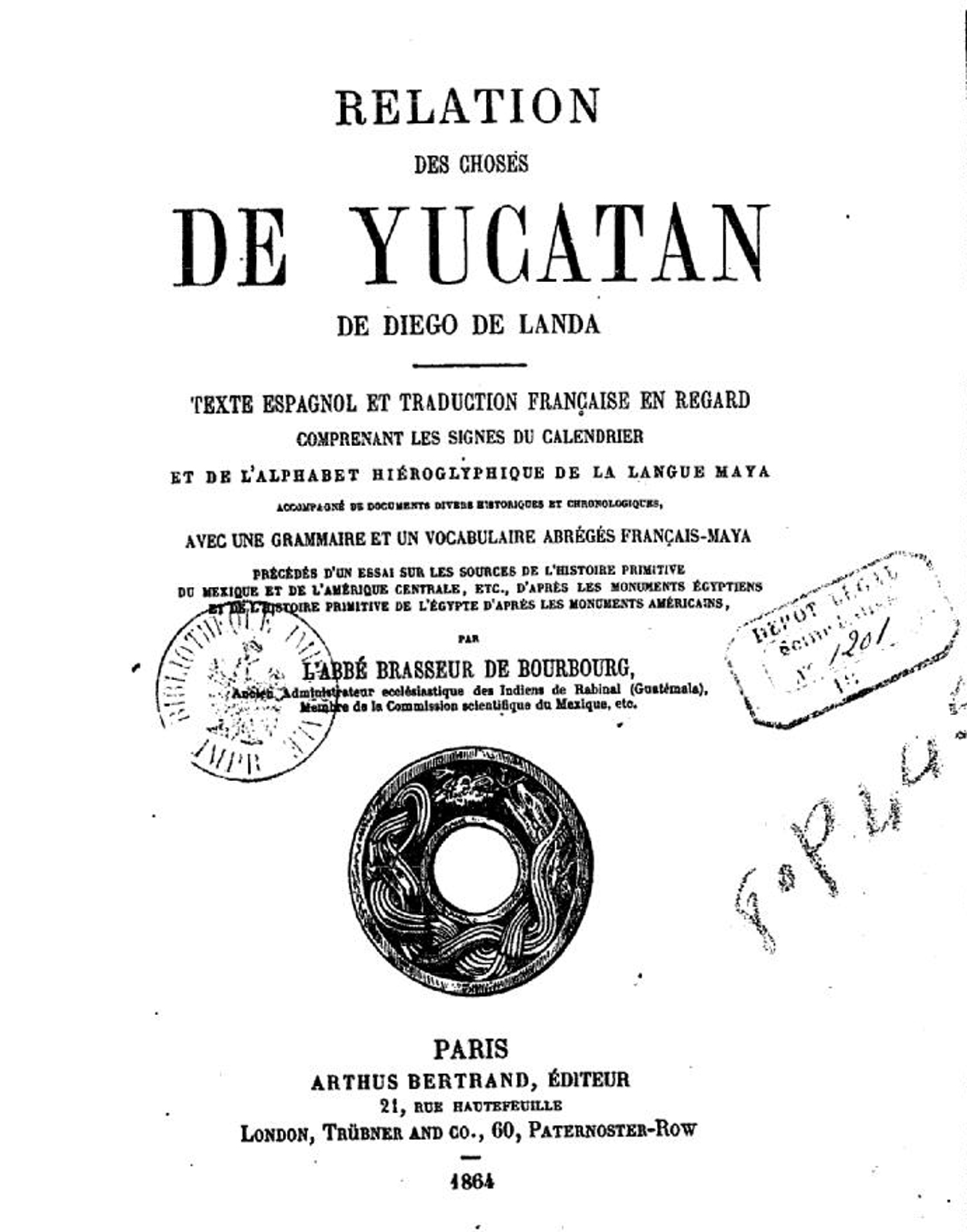
In 1864, Brasseur de Bourbourg transcribed a portion of the Spanish text of the fragment of the copy of De Landa’s manuscript, adding titles and rearranging the order. He then added a French translation to it, which he had Arthus Bertrand publish in Paris as Relation des choses de las cosas de Yucatán de Diego de Landa.

Above: The front piece of the first edition of Relation des choses de las cosas de Yucatán de Diego de Landa.

Since 1864, portions of the fragment of the abstract have been published 14 more times, but few editions include all the text, or all the drawings. For example, William Gates published his version of the abstract in English in 1937, but without many of the original drawings and with the inclusion of many more drawings and notes that were not originally contained in the scribes’ abstract. This work was reprinted in 1978 by Dover Publications. In 1983, Ediciones Dante reprinted the 1938 version by Pérez Martínez, but this Dante version also lacks many of the abstract’s drawings and the pages have been re-shuffled.

The result of all this loss, redaction, copying and reshuffling is that the published versions of the texts that most people have come to believe are faithfully typeset copies of the original Diego de Landa manuscript are nothing of the sort. They are simply copied snippets of copied snippets, rearranged in various orders. The original Diego de Landa manuscript is nowhere to be found, as far as we know, no longer exists.

Xcaret: Misnamed and misplaced

Q: Who gave Xcaret its name?
A: Two lost Americans with a bad map

Copyright 2012, Ric Hajovsky

From the first time the Spanish set foot in the Mayan village of what we now call Xcaret, they called it Polé or Ppolé, from the Mayan root word p’ol, which means “merchandise” or “trade” in Yucatec Mayan. The village was first reported by Juan Grijalva, who saw the buildings in 1518, but did not land. Francisco el Adelantado spent several weeks there in 1527 and 1528. He too referred to the Mayan town as Polé. His son, Francisco Montejo the Younger, visited the town in 1543 and continued to call the town Polé. Polé was listed on the 1549 tax census (population 76) and again in a report by Padre Cristóbal Asensio in 1570. In 1582, Polé was listed as having one of only five churches of the entire coast of Quintana Roo. In 1571, the name Polé is recorded once more when several Maya from the town testified in the trial of the French corsaire Pierre de Sanfroy. In 1590, documents list the batab of Polé as Diego Malah. In 1601, the batab of Polé was listed as Juan Ye. The first map showing the location of Polé was the Juan de Dios Gonzalez map of 1766. The name Polé remained on maps through the 1829 Lapie map, the 1843 Catherwood map, the 1864 Malte-Brun map, the 1874 García Cuba map, and the 1878 Berendt map. This last map, however, contained a serious error; all the towns along the coast were shifted 35 kilometers north of their actual positions. Unfortunately, it was this 1878 map of Berendt’s that Gregory Mason and Herbert Spinden used on their Mason-Spinden Expedition, when they traveled for two months along the Quintana Roo Coast, recording Mayan ruin sites and collecting bird specimens. When they came across the ruins at Polé, the map they had in their possession showed the town of Polé was 35 kilometers to the north of its actual location, and the map showed nothing of note where they were standing.

Pole/Xcaret map 1878

Above: Carl Hermann Berendt’s 1878 map of Yucatan had Polé placed 35 kilometers too far to the north.

Unaware they were looking at the ruins of the same buildings that the Montejos and others had called Polé, they christened it the “new” site Xcaret, after a small ranch nearby.  The name stuck like glue.  For many years after Mason and Spinden published the map of their expedition showing Polé and the Xcaret in two different places, other cartographers followed suite, locating the same town, now with two different names, in two different locations, miles apart from each other.  It has only been since the 1960s that the two locations of the same town have been rejoined and repositioned in the correct location, but now with the wrong name; Xcaret.

2022-08-30T19:59:47+00:00By |Maya History|

Chichen Itza: A story of Mass Delusion

Shadow on the Stairs: A story of mass delusion

Copyright 2015, Ric Hajovsky

Today, the great pyramid at Chichén Itzá (known as El Castillo), is covered with a smooth and unbroken sheath of limestone blocks. The stairways are also made up of finely-cut limestone and the balustrades are straight, square-edged, and well defined. It is due to this sharp-edged veneer of stones and the arrow-straightness of the balustrade that the corner of the pyramid is able to cast its seven triangles of light and shadows on the side of the staircase during the spring and fall equinoxes.

There is no question that the shadow appears. The question is who is responsible for the calculations that went into placing the huge pyramid so precisely that this shadow effect happens only at that time of the year? The tour guides, websites, and popular books all agree that it was the ingenuity of the ancient Maya that accounts for this amazing feat of engineering. However, the answer actually is that the shadow is an accidental result of the reconstruction (note I did not say “restoration”) that the pyramid underwent in the 1920s.

What happened was, the Mexican government made a coldly-calculated decision. Based on the advice of Alfred Kidder of the Carnegie Institute, a plan was designed in which two goals could be met: The American institute could have permission to excavate selected sites in Chichen Itzá, and the Mexican Government could reconstruct certain buildings in the ruin site with the funds provided by Carnegie. The idea of the Mexican government was to build a first class tourist attraction. One government document written in 1921 stated: “Si se puede mantener Chichén Itzá como lugar interesante y bello, va a volverse, sin duda, una Meca turística y un recurso valioso…”

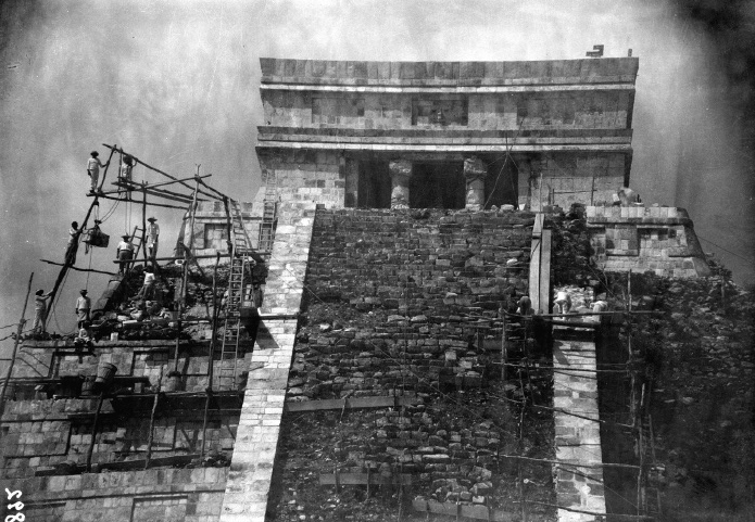
Miguel Angel Fernández was in charge of the initial stage of the restoration work undertaken at the Castillo and the Ball Court in Chichén Itzá. He was a slow and methodical worker, using only original stones from the ruins to restore and stabilize them. He worked on the project from 1922 until 1924, but left when he was presented planes with which to REBUILD certain of the ruins according to the government’s idea of what the ruins should look like, not based on any archaeological evidence, but rather towards the goal of making an eye-popping tourist attraction. Before he left, however, he oversaw the start of the rebuilding of the stairway (with all-new stones) and the recovering of two faces of the pyramid with newly cut limestone, which replaced the old stone covering which had been carted off years earlier and reused as building material on nearby ranches.

Archaeologist/architect Daniel Schavelzon wrote in his 1986 article, Semblanza: Miguel Angel Fernández y la Arquitectura Prehispánica (1890-1945): “Es evidente que la reconstrucción exagerada y sin demasiadas evidencias que se hizo en el Juego de Pelota —en especial la de los dos templetes—, contrastara notablemente con el minucioso trabajo de anastilosis que Fernández había hecho en el mismo conjunto. Y ni hablar de las contradicciones existentes entre su restauración y su consolidación del Templo del Castillo y lo que hizo más tarde.” “It is evident that the exaggerated reconstruction made with little evidence in the Ball Court – especially that of the two temples – contrasted markedly with the meticulous work of anastilosis* that Fernández had done in the same set. Not to mention the contradictions between his restoration and his consolidation of the Templo del Castillo and what they did later.” * Anastylosis is an archaeological term for a reconstruction technique whereby a ruined building or monument is restored using the original architectural elements to the greatest degree possible.

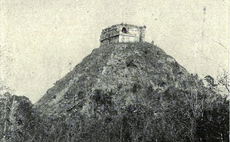
Above: The pyramid as it looked in 1860.

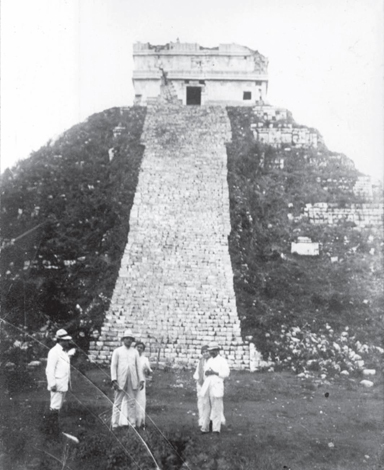
Above: The pyramid in 1905.

The first attempt to rebuild the Chiche Itza pyramid's stairs in 1910

Above: Reconstruction began in 1910 with the building, from scratch, of a new stairway. This first attempt at rebuilding the stairs with recycled stones was later torn out and new blocks cut for the stairs.

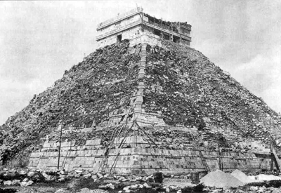
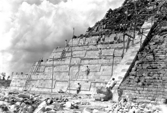
In 1922, the serious reconstruction work began. New stones were cut for the veneer, and the taluds and tableros of the pyramid’s sides were rebuilt from the bottom up.

rebuilding the pryamid

The stairway balustrades, which had been removed and reused as building material long ago, were rebuilt from scratch.

Work stated on rebuilding the Chichen Itza Pyramid in the 1920s

The temple at the top of the pyramid was rebuilt as well.

The newly built Chichen Itza stairway in the 1920s

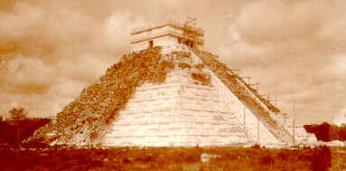
Little by little, the new pyramid began to take shape:

almost done rebuilding the Chichen Itza pryramid in the 1920s

Above: The pyramid in 1925, nearing completion.

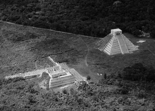
Above: The newly rebuilt pyramid in 1929, in a photo taken by Charles Lindbergh.

The shadow was first noticed in 1928, but since the archaeologists were aware of their drastic rearrangement of El Castillo pyramid’s exterior, they paid no attention to it. It was not until 1973 that Mexico City attorney Luis Enrique Arochi Flores saw a photograph of the shadow and began telling people about it and linking it with the god Kukulcán. He later published a small book about the shadow, La Pirámide de Kukulcán, su simbolismo solar.

Not long after Arochi visited Chichén Itzá to photograph the shadow for himself, tour-guide and self-promoter Adalberto Rivera began to tout the phenomena to tourists. By 1976, the Yucatan government had taken notice of the new interest being generated in El Castillo, and decided to begin promoting the idea in order to boost attendance. Riviera used his connections with INAH in Mexico City to get named the “Official Interpreter” of the phenomenon, alienating some of the state officials. He lost his quasi-governmental position in 1996, but made a comeback in Cancun selling his book on the subject, which blended Gnosticism, spiritualism, numerology, and various symbols from Far Eastern religions into the phenomenon.

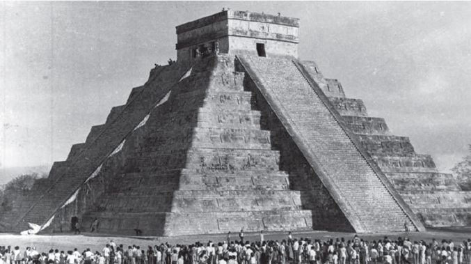
Above: The attendance during the event in 1975 was more than anyone expected.

In 1982, José Díaz Bolio, a writer, poet, and aficionado of archaeology, wrote his book La Serpiente de luz de Chichén Itzá. This book just added fuel to the fire. Attendance at the ruin site during the equinoxes began to spike, and newspaper articles and news broadcasts started promoting the event. Soon the state government in collaboration with INAH began to selling the idea of an equinox ritual for tourists. The idea worked much better than anyone’s wildest dreams and now over 90,000 people visit the ruins each year during the equinox periods to enjoy performances by dancers and musical groups.

In 2007, Chichén Itzá was named one of the “New Wonders of the World” by the private commercial organization “New7Wonders Foundation,” in a contest held via the internet that was open to unlimited, multiple votes by organizations promoting their country’s particular entry. The contest received much criticism at the time and was boycotted by several countries because of its unscientific methods of recording votes.

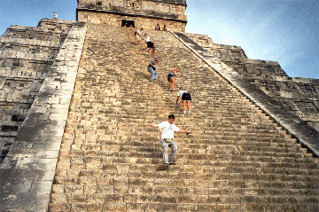
Above: El Castillo today, shortly before they stopped people from climbing up the stairs. This prohibition was not made to protect the new stones, but to stop people from falling after a tourist fell to her death while climbing on the pyramid.)

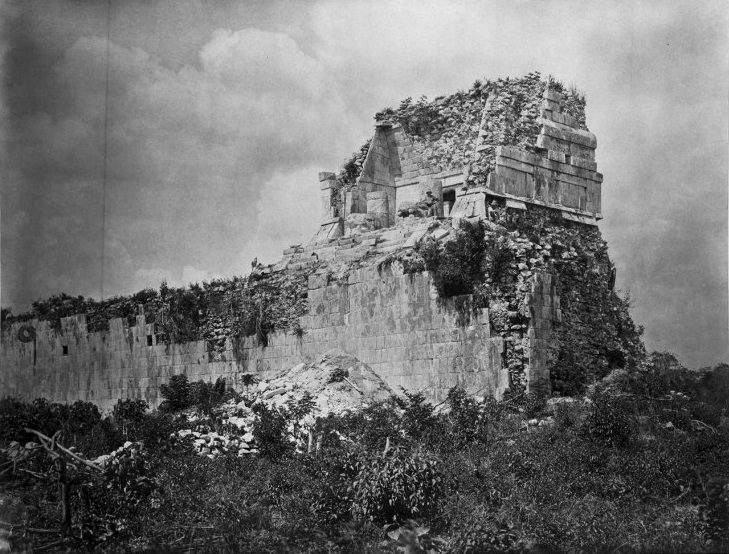
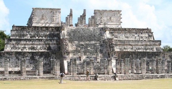
El Castillo wasn’t the only ruin in Chichén Itzá to be rebuilt to be what the government thought the original building “should have looked like.” The Temple of the Warriors and the East Temple of the Ball Court were reconstructed as well. The East Temple at the Ball Court was in terrible shape when it was discovered. The front face and roof had fallen away and many of its stones had been stolen, to be reused as building material. Below is what it looked like in 1889:

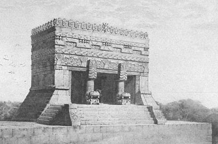
So a plan was drawn up of how they wanted the building to be reconstructed, not based on any evidence of how it may have looked originally, but instead they used a hodge-podge of design elements copied from buildings on other Maya sites…

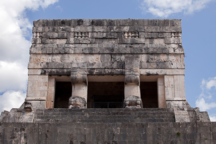
… and then they rebuilt the temple exactly according to that plan:

As is plainly clear, the new, reconstructed façade of the building is a complete invention, dreamt up by Alfred Percival Maudslay, the one who drew the plans for the rebuilding of the structure.

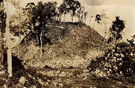
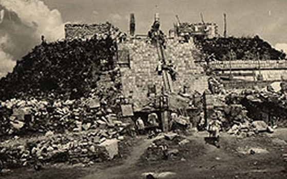
The same process was applied to the Temple of the Warriors. Below is what it looked like when it was discovered:

Below is what it looked like during its reconstruction:

And, finally, below is what it looked like when the work of building it anew was completed:

To read more about the crazy myths, wacky theories, and well-publicized misinformation about the ruins at Chichén Itzá, check out my book on the subject at Amazon Books

2022-08-22T22:22:17+00:00By |Maya History|
Go to Top