DIFFERENT MAPS OF COZUMEL
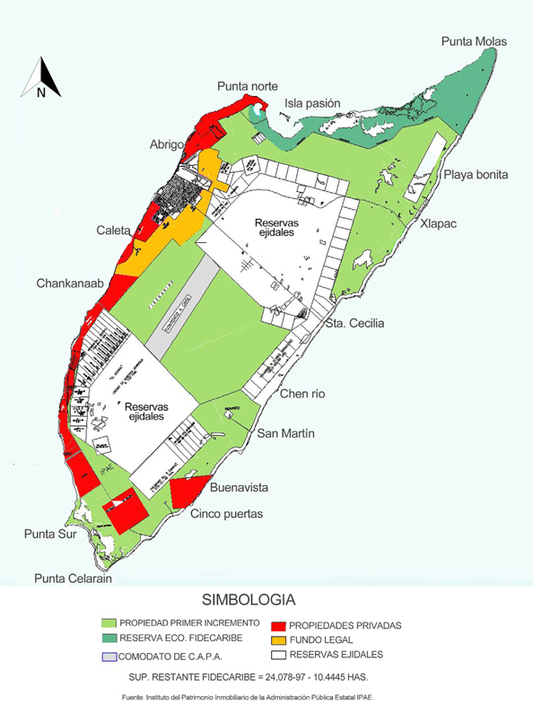
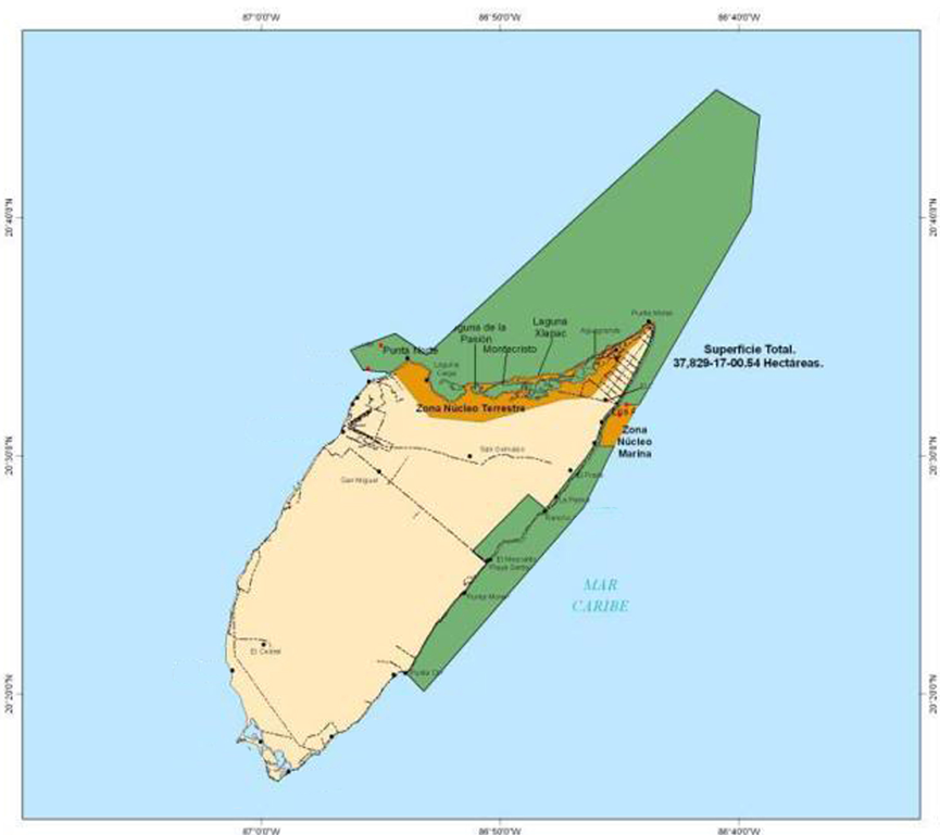
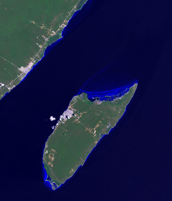
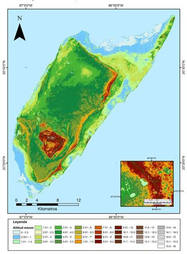
Below are several maps of Cozumel showing nature reserves, elevations, cenotes, ruins, property types, National Underwater Pak boundaries, the northern dirt track to Punta Molas, and a satellite view of the island.
Cozumel northeast ocean protected area
Cozumel Satellite Map
Elevation by LIDAR
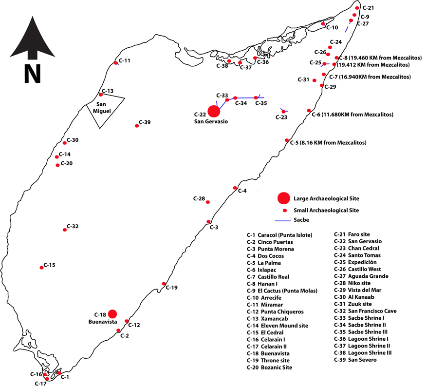
Cozumel Ruin Sites
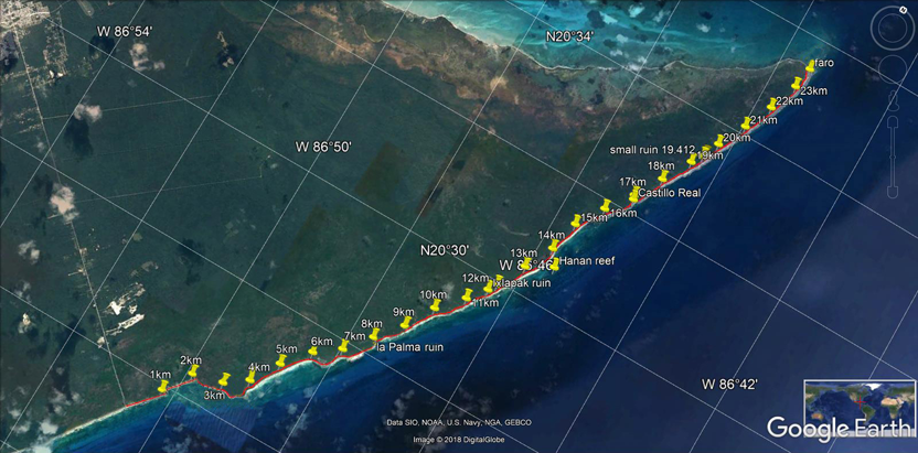
north coast road
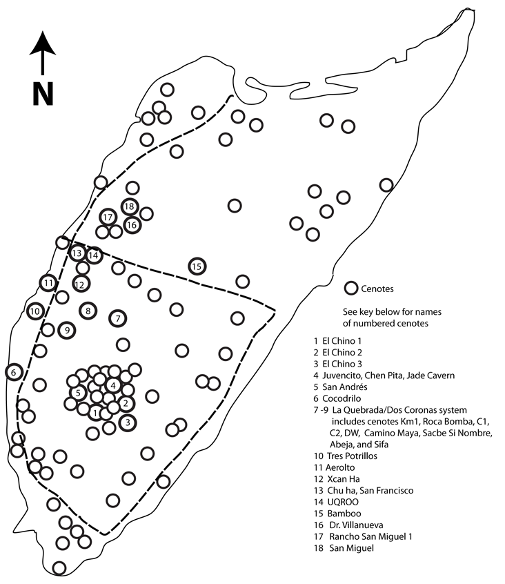
Cenotes
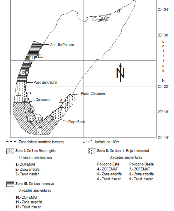
Underwater Reef Park
Property types on Cozumel
